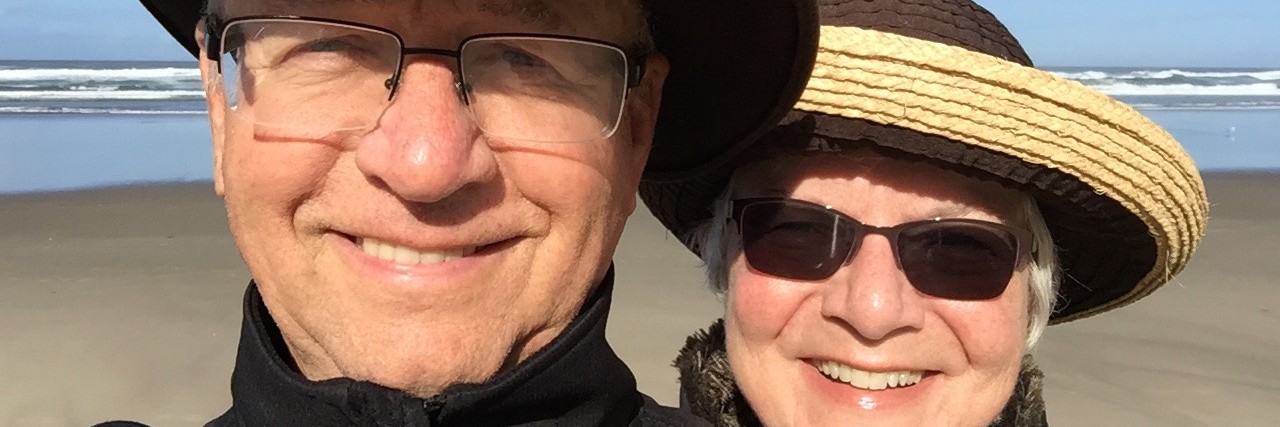
… to everyone who wished me a Happy Birthday recently. I sincerely appreciate it and feel blessed that Diane has allowed me to live this long. Three quarters of a century is a significant number … and, she made it so much better by spending half a century of her life to get me here.
Today is May 19th and we’ve been gone from home since Thursday May 9th. Tomorrow I will officially be 3/4 of a century old. Some folks may think I passed that lofty goal long ago simply because of my frail appearance but that’s deceptive. Only my legs and arms are frail. The rest of me is quite robust and beefy, almost because I always eat what I order, or dish up for myself at home, even if I don’t want to. This contributes a great deal to the beefy reference.
Our first stop on this adventure was Wheeler, Oregon where we stayed for three days. Upon arrival I found a likely spot to disconnect Diane’s vehicle from the RV. When I disconnected the flat four connector for lights i discovered that one of the male pins was missing when I apparently turned too sharp and pulled it loose from the RV and dragged it all the way from St. Helens to Scappoose where the propane guy pointed it out to me when we stopped to fill our tank. I didn’t notice the missing pin when I plugged it all back in so we didn’t have a right turn signal showing on the tow vehicle, which really wasn’t a problem because the RV lights are higher than the car.
I didn’t, however, notice the missing safety cables until I went to disconnect them, also. I blame Jeff for not noticing they were missing before we left because he helped me put the RV and car together before leaving home. Yes, it’s surely his fault. I never forget things like that when left to my own devices. Well, maybe I don’t forget most of the time is more accurate.
Considering the necessity for getting replacement parts I deemed it good fortune that we were at Nehalem Bay, a mere 36 nautical miles from the nearest Costco and O’Reilly’s one of which was bound to have the parts I needed. We went the next day and confirmed that belief then had lunch at Norma’s in Seaside. Normally it’s a good place for a good crab Louie, but that wasn’t the case this trip. It was pretty, but not as tasty as I would have liked.
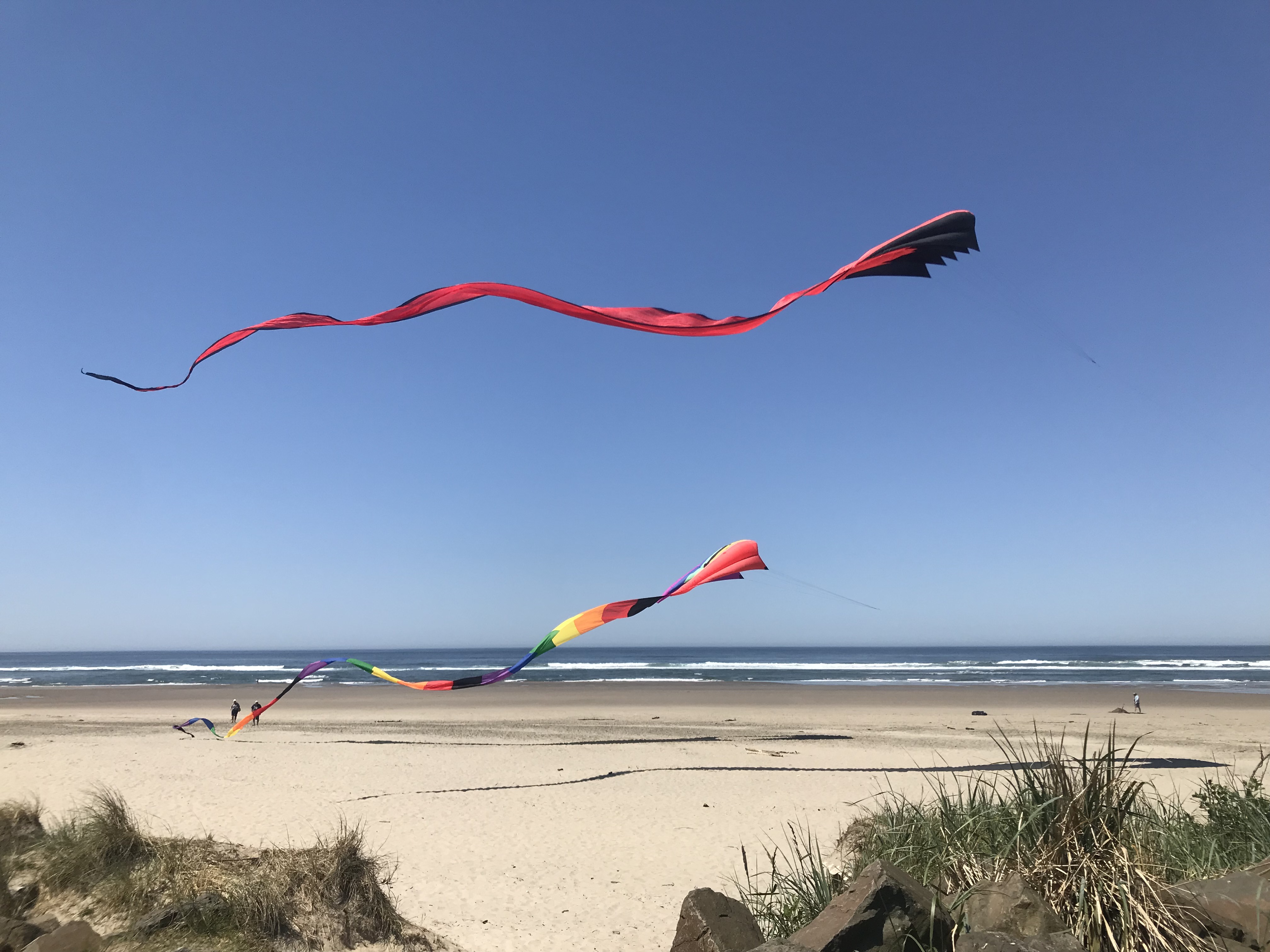
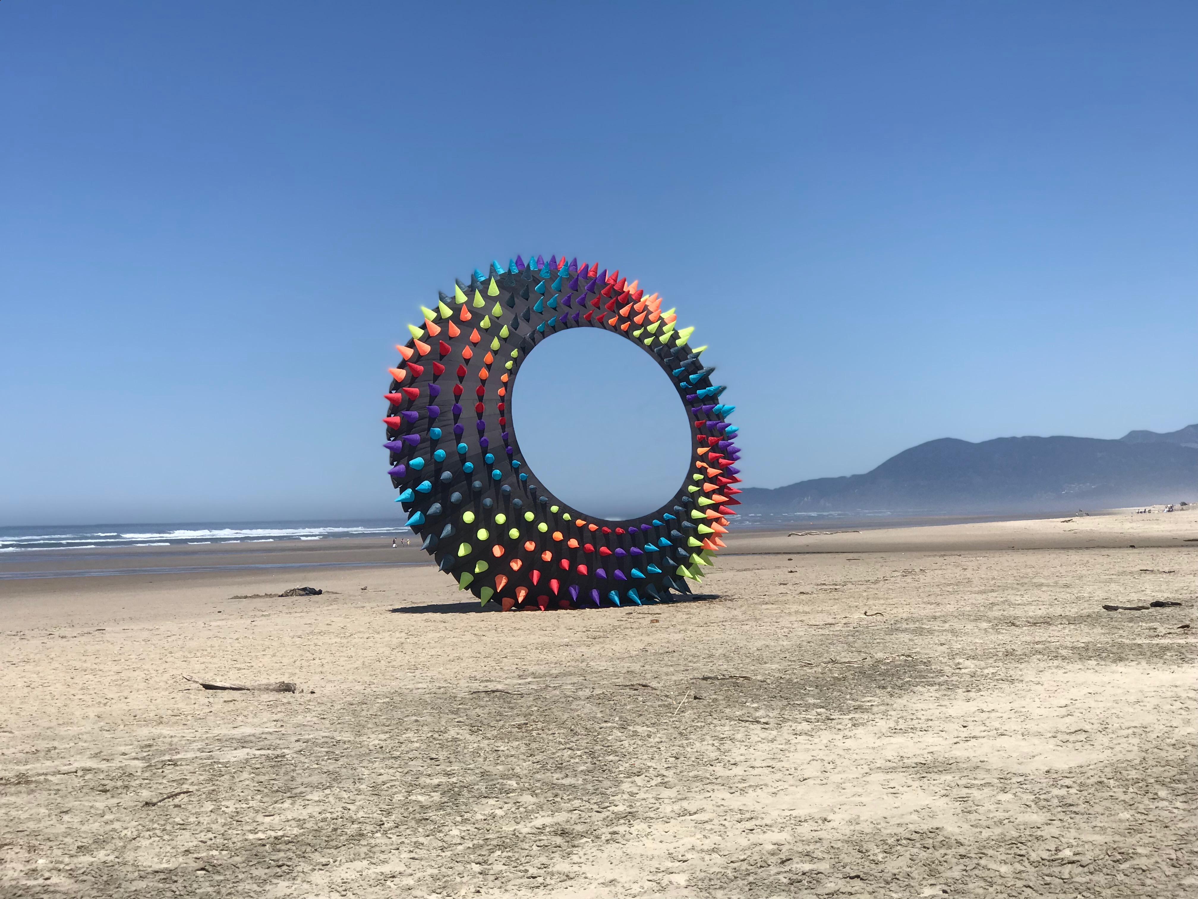
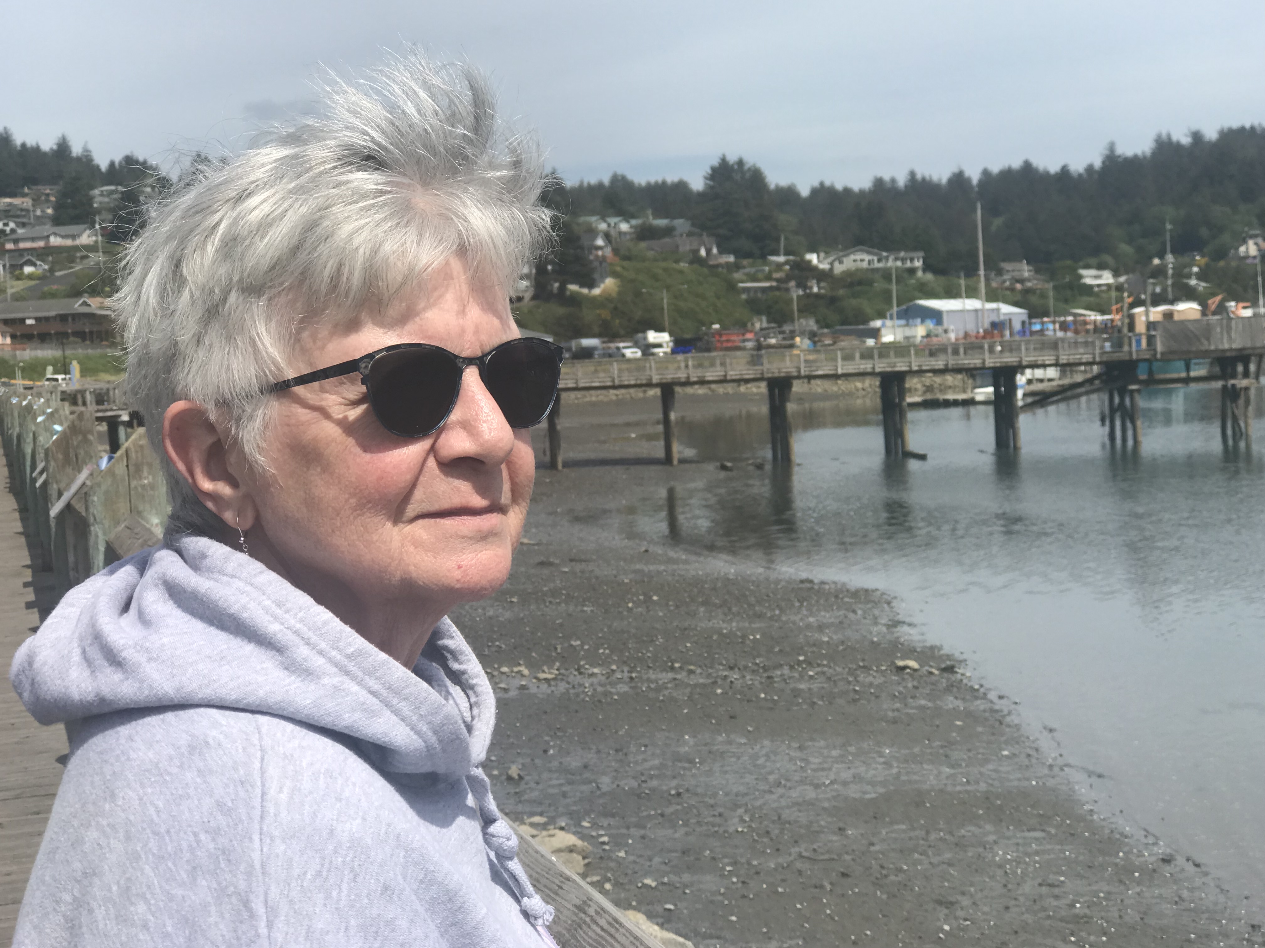
The second day we visited Rockaway Beach which is just a wee bit south of Garibaldi where we visited with a nice lady in the Chamber of Commerce caboose next to the public parking lot. Yes, it’s really a caboose and you can’t miss it. Didn’t get her name but that’s OK. She was very informative and helpful reporting that the Kite Festival they normally have this time of year was cancelled by the city. But, there was one hardy fellow that had numerous huge kites in the back of his Tahoe and was busy anchoring them on the beach and getting them into the air.
When we first walked down to the water only two were flying and we walked under them.
On the way back to the parking lot he’d anchored a third kite but the breeze had dwindled to the point where the originally aloft kits were down and the third was just kind of rolling around on the sand. Still, it was quite magnificent. The owner said it was called a Bol. I don’t know what that means and I’m not going to look it up. This thing is easily 25 feet in diameter.
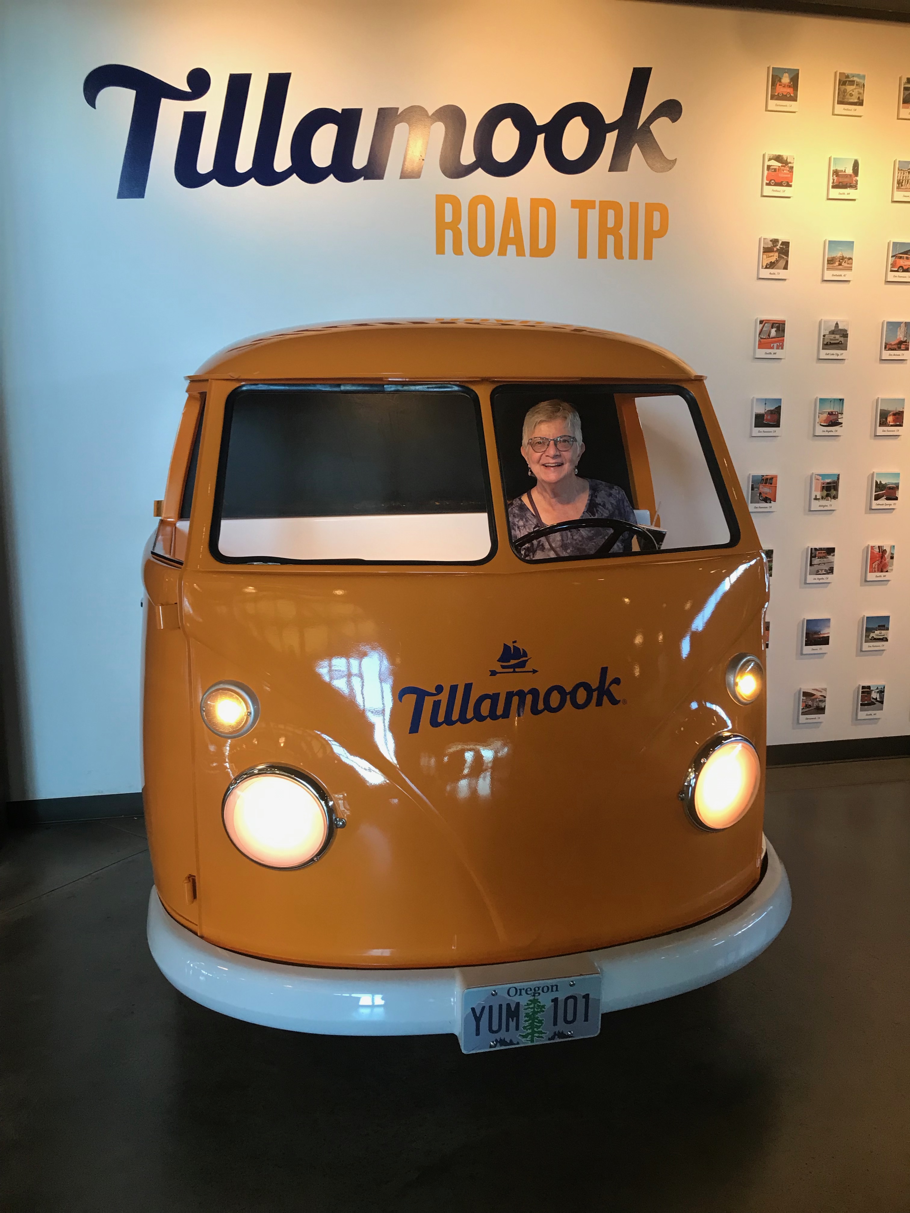
After having our fill of kites, we continued south to Tillamook where we indulged in lunch at the Cheese Factory. Amazingly, the parking lot was far from full even though the weather was pretty nice and a good time to eat Tillamook ice cream outside. Even so, we chose to partake inside with the other riff raff. We both had Tillamook Cheeseburgers with one order of fries. I think I read somewhere that the beef used to make these hamburgers from retired dairy cows from which they obtained tons of milk to make unknown quantities of cheese over the years. Some may find that a hard fact to deal with, if it were true, but I don’t think it is. Actually, I just made that up but, really, who knows where hamburger comes from.
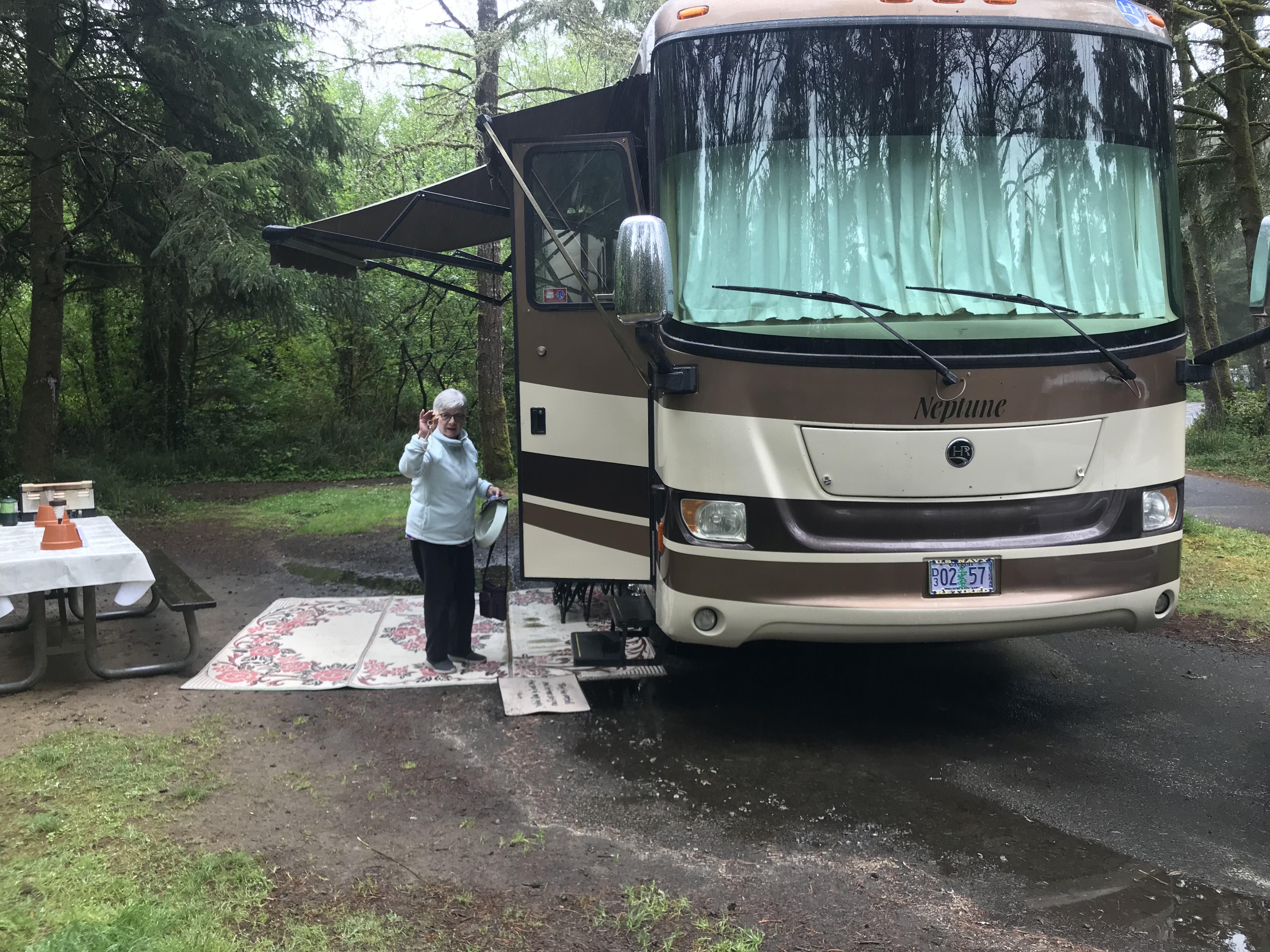
We arrived at Beverly Beach State Park, the second stop on our trip, on Sunday May 12th. It was a grueling 4 hour drive which I had to do all alone because Diane has yet to drive the RV. One of these days she will, and she’ll do a great job, I know. Just not yet …
On Monday we drove down to Newport and visited old town by the fishing boats. While there we bought a pound of Dungeness crab for a mere $40. That way we could make our own crab Louie’s that tasted really good, which we did, twice. I’m happy to report, so far, that over indulging in crab has not caused my gout to rear its ugly head. I’m always prepared for that but don’t worry about it because I figure the crab is worth the terrible pain and the need to limp for a few days. I have a cane for just that reason.
On the way back to Beverly it started to rain and we returned to a semi-flooded camp site.
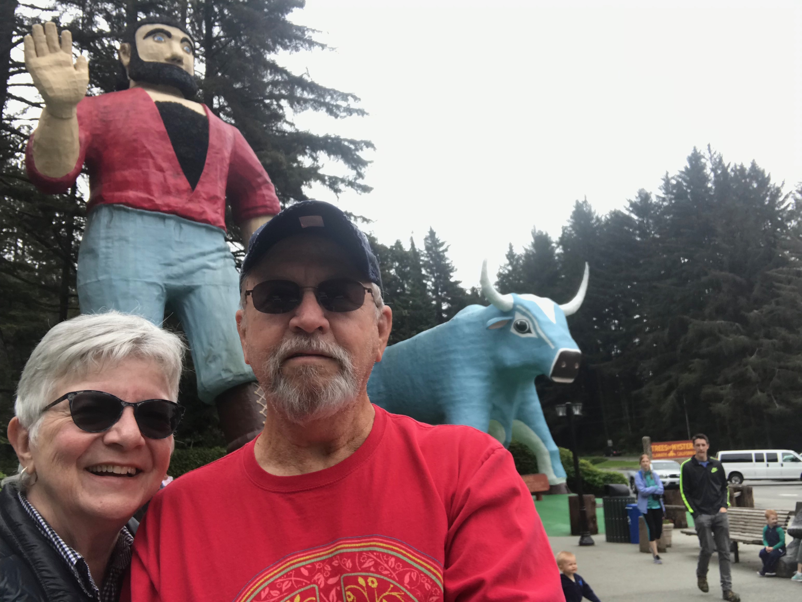
On Wednesday, May 15th we did the longest leg of our trip south to Harris Beach State Park in Brookings which is anywhere from 1/8 to 1/2 an inch from the California border depending on which map you look at. Either way, it’s close, and made it possible for us to revisit the Trees of Mystery down that direction. Perhaps you’ve been there and might recognize these guys …
One of the main reasons we made this section of the trip, in addition to seeing such magnificent forests, was to purchase another giant sequoia to plant at home. We had one from our trip two years ago and it was growing well until we killed it. Now we have a replacement and it was good to see all those incredible giant trees. It’s a very humbling thing.
On the trip back to Harris Beach, we stopped in Crescent City for lunch at The Apple Peddler where we stopped with Lydia and Ceiarra two years ago. They welcomed us back with open arms and tried to give us the same booth we had then but we refused and sat in the booth just inside the front door. Perhaps Lydia and C remember this stop. One thing is different there since we visited … they apparently have a machine that cooks chicken like colonel Sanders. Unfortunately, the day we visited, it was broken. They said so.
Had it been working we could have purchased a 100 piece bucket of chicken for about $96. I was so bummed.
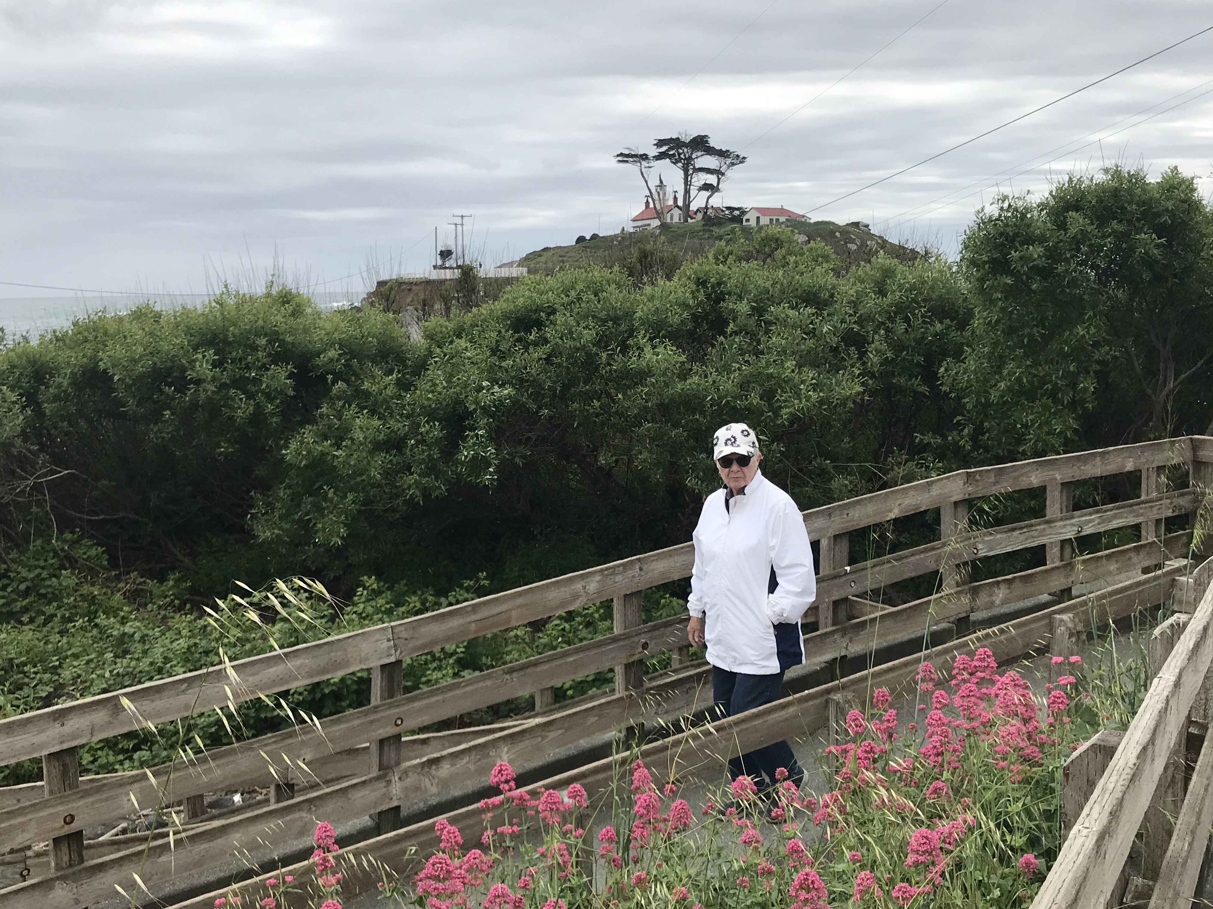
After eating we wandered around town and found signs that led us to the water front and a lighthouse that’s been there for many, many years. So, we visited it and Diane convinced her knees that it would be OK to climb all the way to the top, up narrow winding stairs and a short vertical ladder. She did it, enjoyed it and didn’t come down with any debilitating injury because of it. That made me very happy.
Then we went back to Harris Beach to just hang out. It rained most of the time until today, which was beautiful so we went to Harris Beach to watch the water. It was very entertaining.
After that, we took a tour around Brookings to see what’s here. Diane said she did some research and discovered that according to some obscure survey, Harbor, Oregon is the best place to retire to in the state. Harbor, in case you don’t know, is separated from Brookings by the Chetco River. Interesting. We drove out into the wilderness on either side of that river to see what was there and kinda liked both sides.
To end the day, Diane lounged in our private yard at the campground …
Grants Pass is a small village in southern Oregon that we generally pass by without a second look except for one time in 1990 when we actually visited the town on purpose so I could attend the Oregon State Bowling Tournament at which I bowled an astounding single game of 265 (or thereabouts) but failed to win anything. But, we had fun anyway.
Anyway, Grants Pass is where we are for this last night on the road and it’s a bit more than a small village now. There’s actually a lot of history and I’d share it with you if I knew, off hand, what any of it is. If, during the course of this discourse, I stumble across something related to history I’ll be sure to share it.
We left Modesto somewhere around 9:30 this morning and arrived at our chosen abode for the evening at 5:36 on the dot according to our GPS. Between those two significant times we traversed approximately 412 miles of mostly scenic territory that included one significant mountain, Mount Shasta, which we saw from 3 specific angles:
I took photos to show you …
1) driving toward it; 2) driving around it; 3) driving away from it.
It is a very pretty mountain from all three points of view even if it’s raining. If you ever make that trip, which Diane and I have done numerous times over the years, you can catch those views going south or north on I-5, and going east or west on Highway 89. Highway 97 also gives wonderful views for southbound travelers which can be extended by connecting with I-5 south and heading east on Highway 89 just past the village of Mount Shasta which, I’m pretty sure, was named after the mountain, as was Shasta Lake.
Hunger and the need for gas occurred about the same time while passing Chico on Highway 99 before connecting with I-5 at Red Bluff. After getting gas at Costco we found a listing for Home Town Buffet which was right up our alley. When we found the place it turned out to be the Hibachi Grill Buffet which was a little disconcerting considering how reliant we are on the information provided during searches on our phones. Normally the information is accurate. In this case we decided that perhaps it was deemed important that we eat at this Hibachi Buffet. We like oriental food so what the heck. We actually said that to each other … “What the heck.”
A little south of Weed, California we encountered a small accident. Before I go into that I feel compelled to dispel any concerns about this town and the reason it was named Weed. The truth is that I actually don’t know the answer but have to agree with you that encountering a town named Weed conjures up all kinds of possibilities, don’t you think? The accident appeared to have involved only 1 vehicle, a truck, but could have easily caused lots of problems for many other vehicles considering how the truck driver landed. Looking at the photo it’s difficult to understand how the truck wound up as it did without without the driver giving it a lot of thought before engaging in this evolution. You decide …
The first photo shows a skid mark going off under the pickup truck that’s being towed by the motorhome, and the second photo shows some stuttering skid marks possible made by the truck from wheel(s). We’re guessing that the driver lost control, for some reason, and ran his truck off the road and completed some truck acrobatics in order to get his vehicle oriented as you see it. The second photo also shows someone tending to the driver. We were there right after the first policeman arrived on the scene so this was brand new. I cannot imagine what was going through the driver of that RV as this unfolded in front of him. What fun.
That was the only excitement during the trip but there was more excitement waiting for us at the hotel. Something in the plate of things I collected to have stir fried (maybe the raw shrimp) revisited me after we checked in demanding a rapid exit for some unexplained reason. Not being in a position to deny this request, I gladly granted it with a sigh of relief that it chose to complete the tour of my intestines instead of demanding release using the portal it used to gain access.
Now I must rest and worry about which part of my stir fry meal will demand release next. It seems to be an on-going thing.
Yes … nine hours from Fresno to Modesto. These two cities are only 104 miles apart – a 1 hr 36 min trip for normal people according to our GPS. Extending that 1.5 hours to 9 was accomplished by taking a side trip to Yosemite National Park on the way. It was just on the way and begging for us to visit. So, we did.
I suspect for most folks planning a day trip to Yosemite is kind of lame, but we’re old, don’t climb up the sheer face of cliffs, and do not hike on trails that scale incredible heights or hike extremely long distances. We just enjoy looking at stuff, not interacting with it. A hike for us is climbing upstairs from the basement.
I gotta tell you that we had the best time ever looking at stuff. We even walked a lot farther than planned and enjoyed every minute.
From Fresno we took California Highway 41 to the park which goes through a very long tunnel that ends with parking lots on either side so folks can park and check out the incredible first view of el Capitan, Half Dome, and Bridalveil Falls.
Driving further in gave us better views.
We stopped at the chapel and took a photo requested by our friend Carolann.
The view from the chapel’s front steps.
Not all of the surrounding forest on the way in and out of the park is pristine green. Recent forest fires came close to totally devastating the entire park, but by some miracle that didn’t happen.
That’s a nasty photo, and typical of a great deal of the forest. Still, there are plenty of beautiful sights to take your breath away.
Leaving the park we took Highway 120 to Modesto. It reminded us a great deal of Highway 1 along the California Coast. Very curly cue for many many miles. It was a long day, but a really good one.
Tomorrow night we plan to be in Grants Pass for the last stop on this trip.
So, here we are in beautiful downtown Fresno, a city we’ve driven past dozens of times over the years but never stopped. I actually don’t know anyone who ever stopped here on purpose. This time, however, we have a motive. For us it’s the gateway to Yosemite National Park on our trip home from Palm Springs. Yes, we could have stretched our day a little further and driven closer to the park, but Fresno was our choice mainly to because of the difference in price for rooms as one gets closer to the park.
Getting here was about a 5 hour drive which is about the extreme limit of how far we like to travel on any given day. We could have gone further today, however, because Diane let me drive for almost a couple of hours. OK, I drove about 1.5 hours. Technically, that’s almost a couple of hours when you round up.
Tomorrow morning we’ll be driving a couple of hours in to the park for the day. Once we’ve seen what can be seen in 5 or 6 hours we’ll drive out to Modesto to spend tomorrow night.
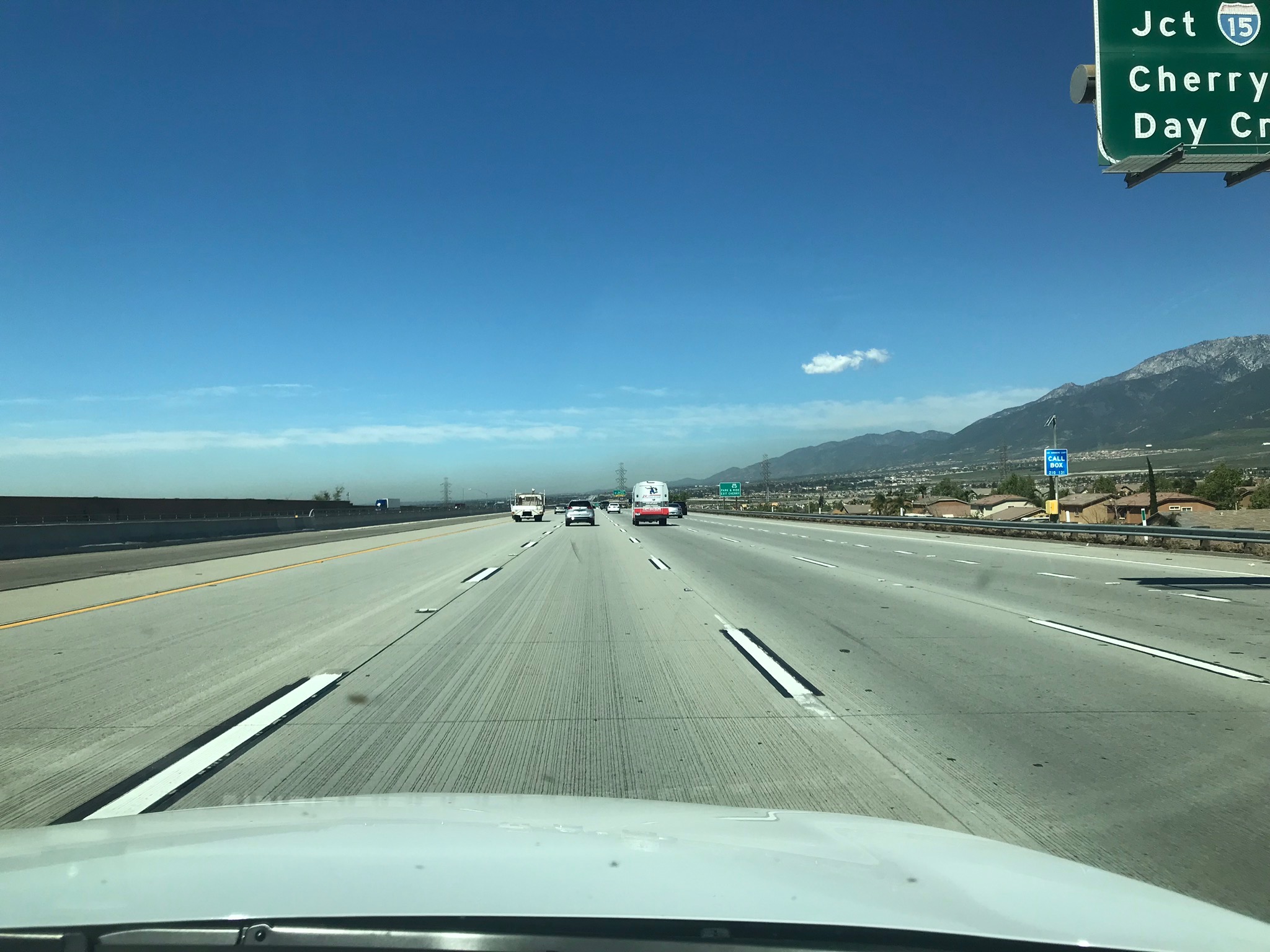
I took a bunch of photos on the drive up, mostly of highway signs to document where we were, so they aren’t very scenic. Just lots of lanes of cement traffic lanes on Highway 99 and I-5 and many other lesser important tributaries of those magnificent roads. Since I took them, I’ll show a couple of them.
Just leaving the northern extreme of Palm Springs. Snow. Who knew?Flowers blooming all over thanks to a wet winter & fall.That brown smudge up ahead is LA air making its presence known as we passed Pasadena.
Regarding that last photo, it’s just more evidence that people who live in LA, and the surrounding area, don’t breath anything they can’t see. Once we got over the first hill the air cleared right up.
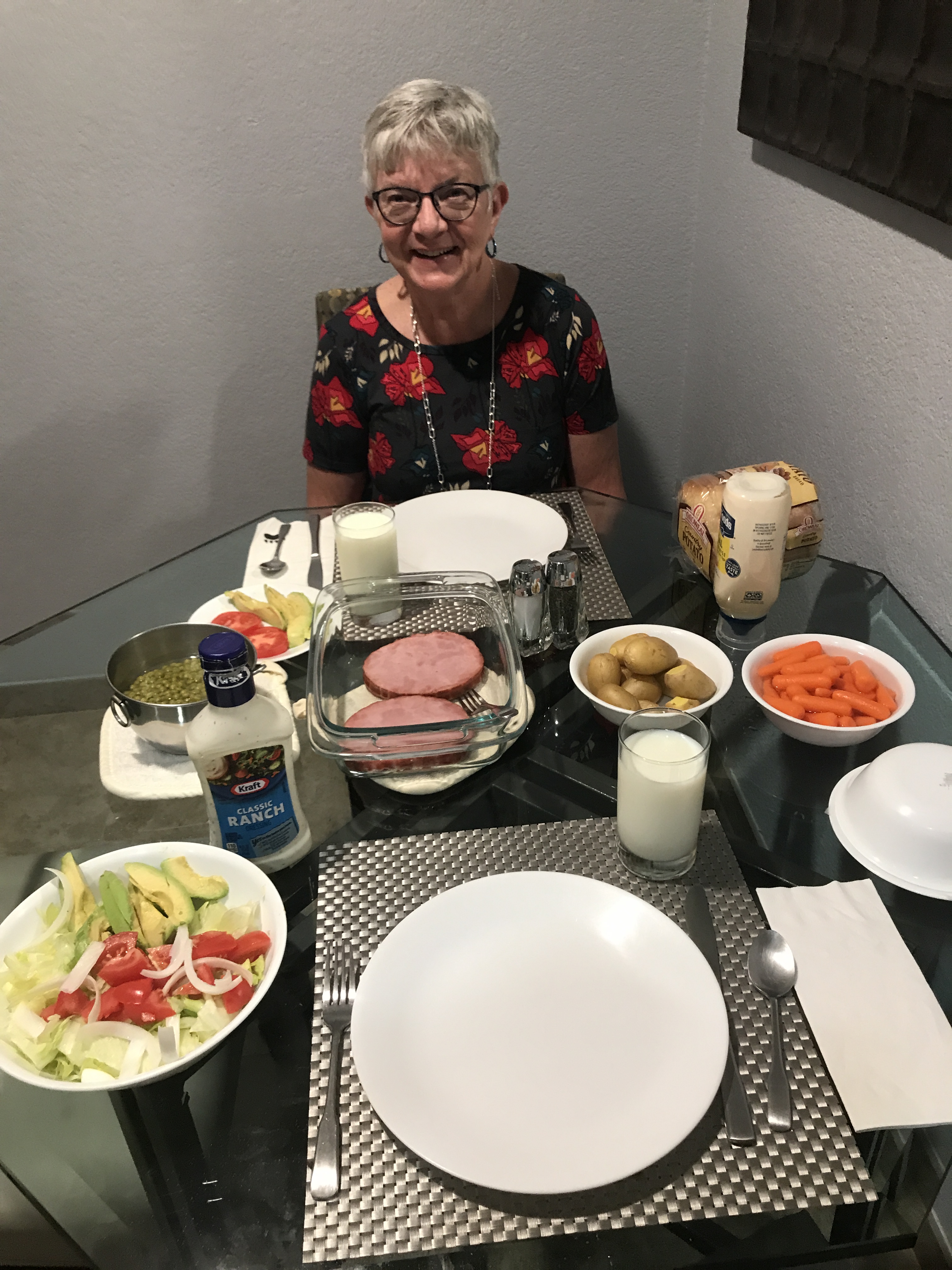
Today we went to Easter service at Our Savior’s Community Church that we’d scoped out a few days ago. We got there at 9:30 for their 10:00 service which turned out to be a good time. Everyone was friendly and the church was beautiful. Unlike other churches, to which we’re accustom, this one didn’t have a bulletin so we could follow the service. Instead, it was all on screens on which were projected lyrics to the songs and scripture verses read by Pastor Rob. It was OK working without a bulletin, but bulletins hare meaningful to me because I’m the one who prints them for our home church, Bethany Lutheran in Warren, Or.
After the service we returned to the condo where Diane whipped up a terrific Easter dinner of ham, tiny peas, and tiny klondike gold potatoes. It was a pretty awesome meal.
Instead of taking a nap after eating, we jumped in the car and drove all over the area, even to the east side of I-10 just to see what was over there. Turns out there are just more towns with Palm(s) in the name and lots more houses. Choices are: Palm Springs, Thousand Palms, Palm Desert, Desert Palms, to name a few. Actually, that’s all the towns I can find with that common word in the name. Still, for a newcomer to the area I can see why the city names could cause confusion. We’ve discovered, in our short visit here, that Ramon Ave is a link that always leads us back to Palm Springs Tennis Club Resort. At least it’s been working so far.
An interesting thing about Palm Springs is that no where in the city is there a parking meter. Parking is free everywhere, including the parking garage located on the main thoroughfare. Also, as our Jennifer pointed out, the streets are amazingly clean. It’s almost like people care enough to NOT litter. Maybe keeping it clean is a tradeoff for all that free parking. That, or people are just proud of their surroundings.
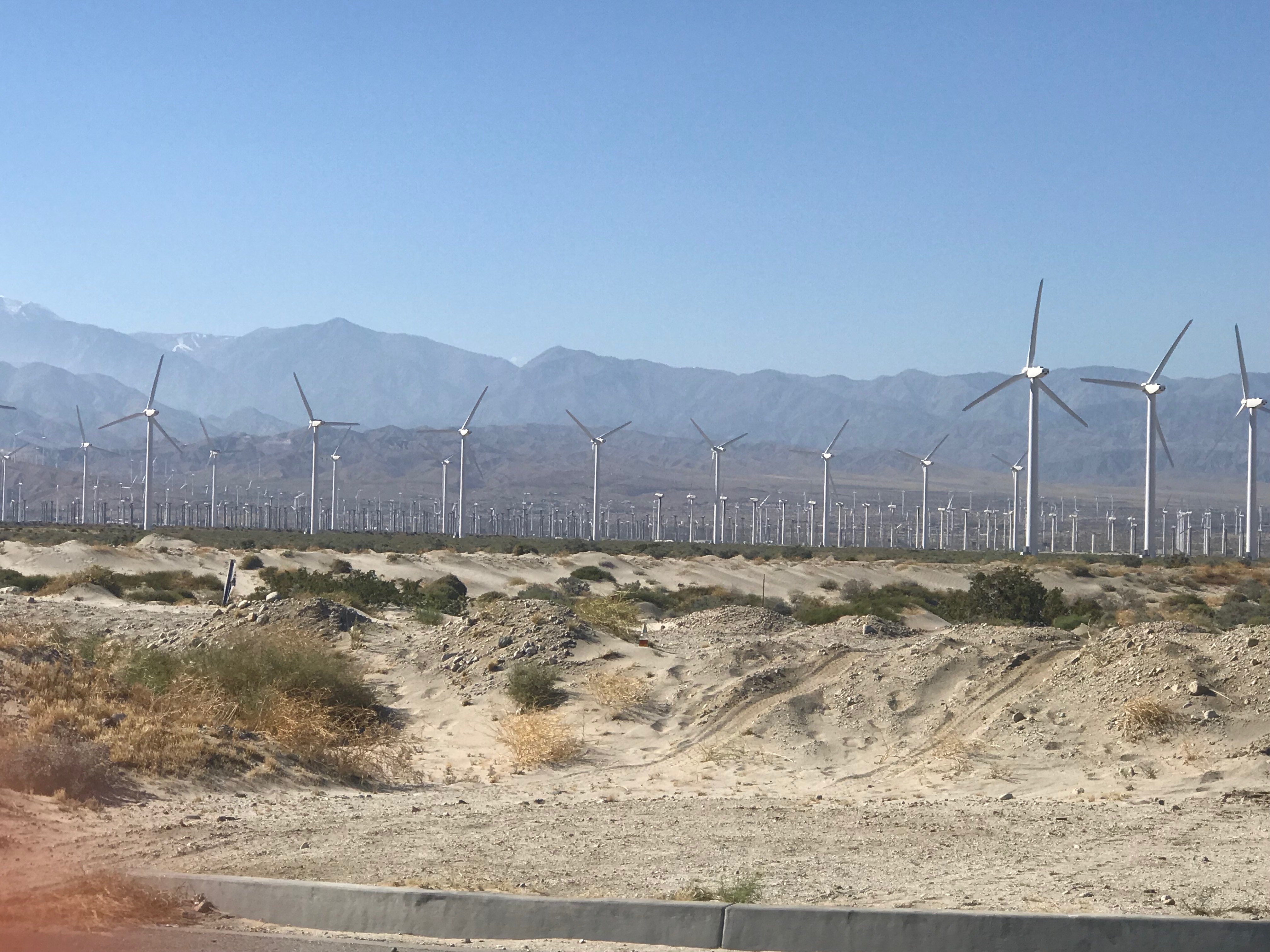
Solar panels are everywhere here which makes perfect sense since the sun shines most of the time. By everywhere, I mean lots and lots of houses have their roofs covered with them. What surprised us was the prevalence of wind power options. We drove through an entire forest of the wind turbines when we arrived last Tuesday, but today we got up close to them so I took a photo. This field is located near the I-10 corridor …
We have these in Oregon, too, but not in such mind-boggling numbers, so close together. Ours are typically scattered loosely across the tops of hills which is nothing like the above photo. If you can enlarge the photo, you’ll see that the turbines seem to taper off into infinity toward the far away hills. If I had to guess how many wind mills are out there, I’d have to say a couple of million. Easily. But, I’d be wrong. Data from 2013 states there were 2700 of them at that time. Another undated report states there are 4000 of them. Now, who knows?
While looking for that information, I was surprised to learn that the Wind Turbine farm in Palm Springs is the oldest facility of this nature in the US. Who knew?
Today we visited Indian Canyons, an area not far from Palm Springs. I’d tell you which direction it is but have no idea and don’t feel inclined to look at a map right now. If I had to guess, I’d say they are south and east of the village. OK. They are south of us. I had to look.
Getting there was simple partly due to GPS but also because of the handy signs that are posted all around the place.
Our initial desire was to hike up Tahquitz Canyon which takes about an hour. After talking with a nice young lady at the ticket counter I made a command decision that it wasn’t in Diane’s best interest to go that direction. It’s uphill going in and is littered with huge steps anywhere from 10 to 20 inches tall. So, we took her recommendation and headed for Indian Canyons. Honestly, not going to Tahquitz was also in my best interest. I talk a good story, but doubt if I’d have made it without a lot of pain from either falling down or from gasping for breath.
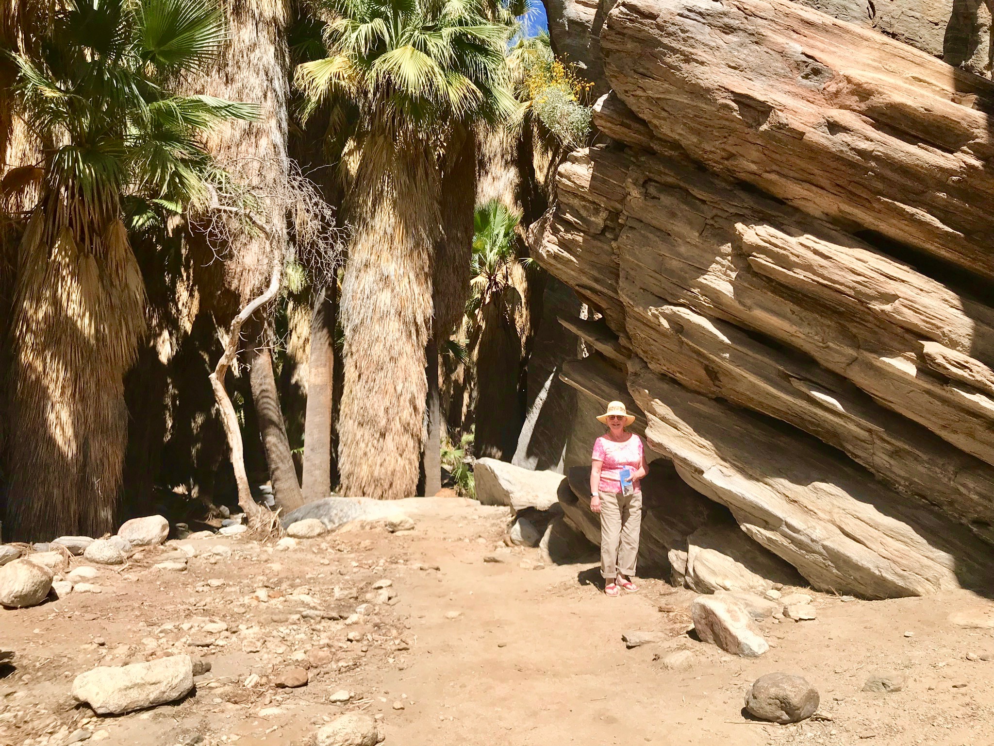
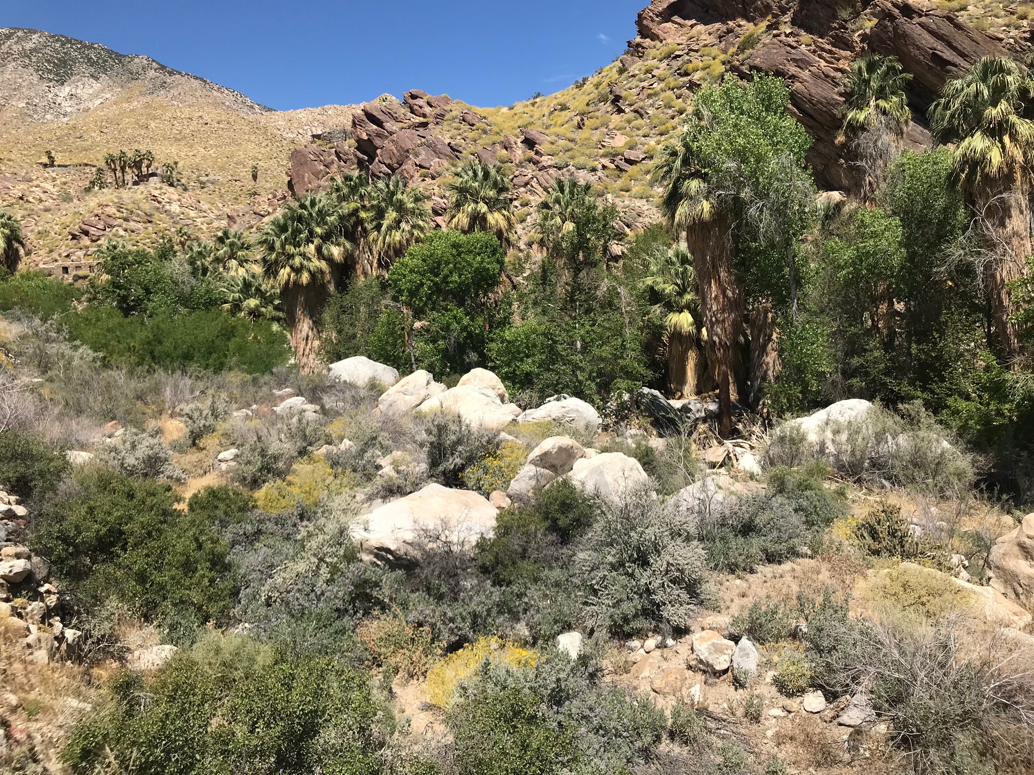
At Indian Canyons we chose to tackle Andreas Canyon, the shortest of the many available choices. According to the map we had it was only one mile long and was lined with green indicating it was an easy one. Some of the others were up to 7 miles long and were marked in red.
This is where the fun begins
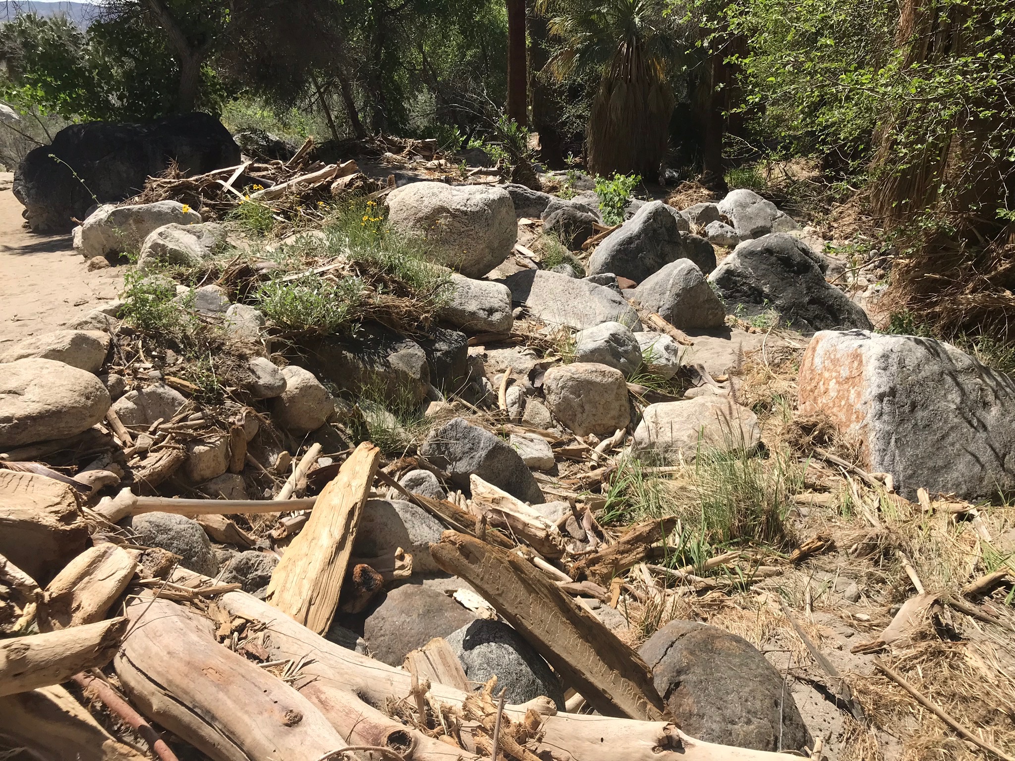
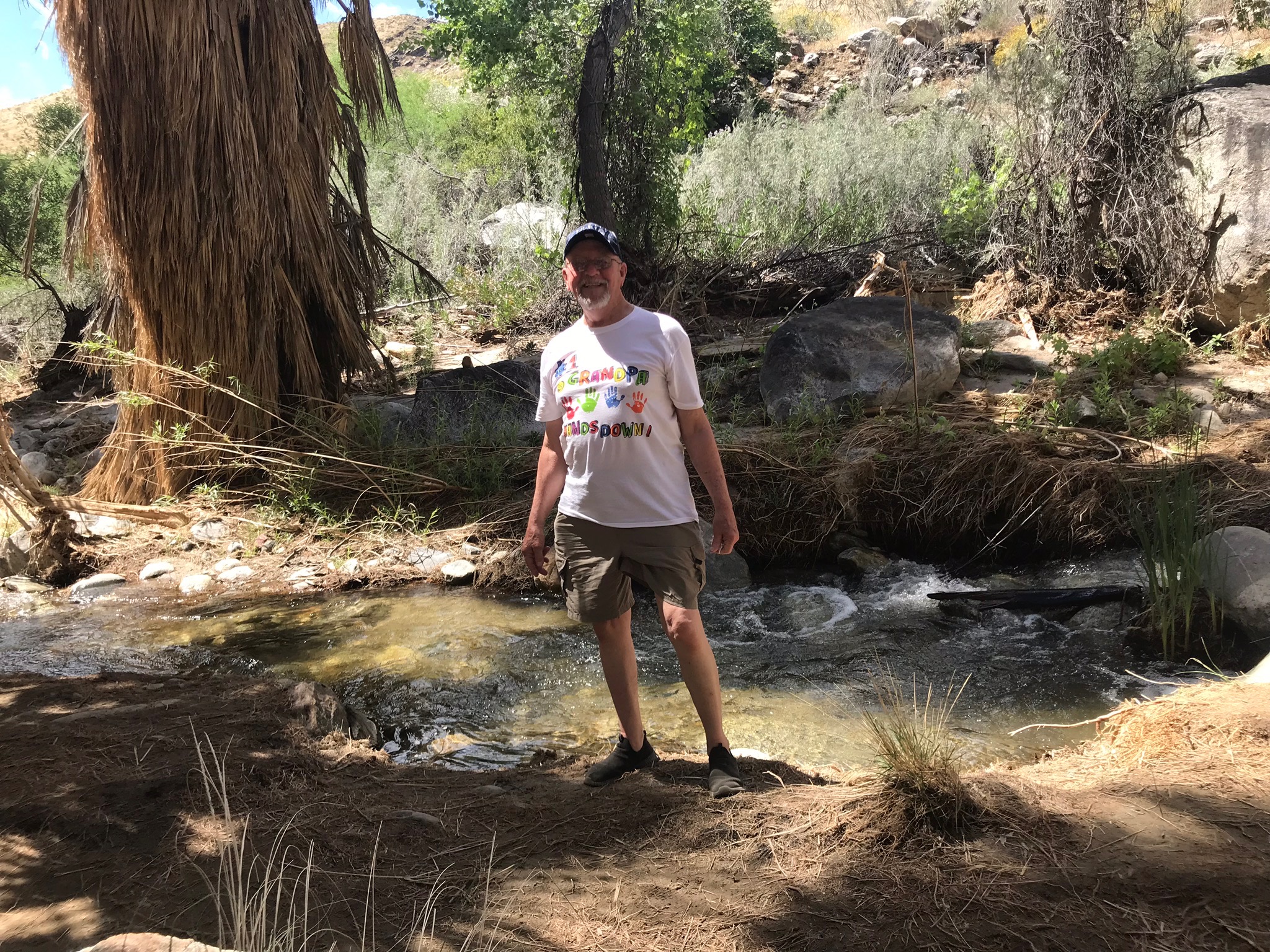
The canyon trail runs along Andreas Creek that has water all year long. It’s crystal clear and pretty cold when compared to the 100 degree temp of the air. Thankfully, the path is shaded most of the time with the myriad California Fan palm trees that are fed by the stream. There are lots of other kinds of things growing but they are pretty short, not good for shade unless you collapse and someone passing by is kind enough to roll you off the trail. The low foliage is good for collecting tons of debris that gets washed down the canyon when the creek gets rough in wet weather. The evidence is everywhere. There are piles everywhere that indicate the water level in the canyon is at times more like a deep roaring river than a sedate shallow creek.
After conquering Andreas we returned to the car to plan our next adventure for this day. I suggested we visit Palm Canyon which is within the boundaries of Indian Canyons. The clincher for Diane was that there is a trading post at the trail head, so that’s where we went.
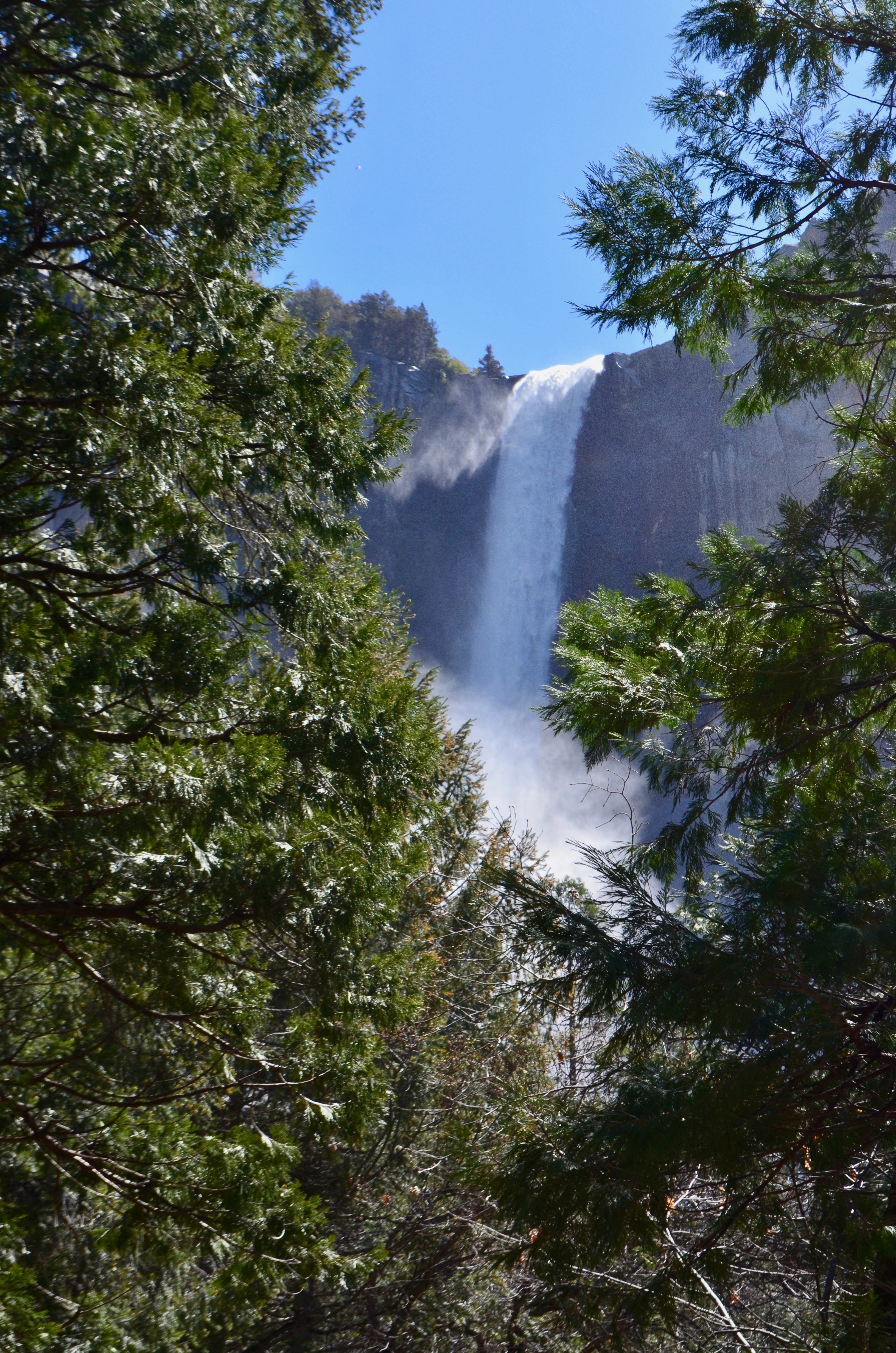
Once there I discovered that Palm Canyon was more than a simple hike away and they advertised that this trail was also a rattlesnake habitat. So I prudently chose to visit a small waterfall falling down a little canyon on the other side of the trading post.
It was a simple and satisfying hike. Got some photos and Diane was just coming out of the trading post when I got back. Great timing.
The road out through Split Rock
Then we went to Ralphs. There are Ralphs grocery stores pretty much everywhere in this area. Makes it handy when you need something. The last time we needed to go there was to get a pool noodle for Diane. This time it was for ketchup and more mayo.
Back at our condo we cooked steaks Diane got yesterday which was pretty tricky because there are no BBQs around and all we have is a microwave. But, it’s also convection. So we fiddled around with its dials and buttons, finally figuring out that we could, indeed, cook steak in this micro. Quite nicely, I might add.
Then we ate, and took a nap prior to getting ready for a good night’s sleep.
Yes, that’s what I see while floating on my back in the pool which is located in Palm Springs, California. It’s a very serene, calming view. We’ve been here for two days and have decided we really like it. To the point where I checked on Zillow and discovered that Cary Grant’s old abode here in town is on the market for $2.9M. When I saw that I just about ripped the pocket off my jeans trying to get my wallet out so we could run right down to the realtor and make a deal. It’s either that, or just rent Leonardo DeCaprio’s home for $4.5K a night. Decisions, decisions. Perhaps we’ll just think about it a while then go back to Oregon where God lives. It’s true. That’s where he lives. He told me.
Getting here was just half the fun.
We headed south from home last Saturday morning about 9 am. First thing to note is that’s a record for us because we’ve never in our lives (that I can recall) have we left to go someplace at 9 am. It’s true that we’ve planned, numerous times, to do that, but generally we get going closer to noon. So, 9 am was good. It gave us time to stop at Scappoose Bagel for a wonderful start to our day. We love their bagels and save them for special occasions. I’d eat one every day if Diane let me but she doesn’t want me to get any roly polier.
After navigating the customary route up Cornelius Pass, to US 26, then right on US 217 to I-5 south, we were officially on our way to Klamath Falls, our first stop. To get there we escaped the helter skelter mess of I-5 by excecuting a tricky left on Highway 58 in Eugene, home of the Oregon Ducks.
It was an uneventful trip on a relatively vacant highway so we loved it very much. We’ve spent too many hectic trips up and down I-5, from one end to the other, so getting off the beaten path was a perfect beginning to our vacation.
We arrived in Klamath Falls fairly early so we had time to relax a bit before calling it a day. So many times in the past we didn’t find a room until we were ready to crash. Now that we’re older, planning ahead pays off. Diane is an expert at that and makes all the reservations on our route. It’s good to know where we’ll spend the night.
The next morning we got up fairly early and amazingly got on the road again at 9 am. Two days in a row. Another modern day record. Go figure.
Day two destination turned out to be Virginia City, Nevada. What a fun place that is … clamped to the side of a cliff, wooden boardwalks on both sides of the main street, tons of touristy places full of nifty trinkets from China, and real-deal shops filled with incredible local art. Quite a mix.
We spent a couple hours wandering around the various shops then decided it was time for dinner. Based on a recommendation from our host for the evening at the Virginia City Motel which is located at the southern end of town, top of the hill on the left. It’s an old place but very nice.
Dinner was at Cafe Del Rio where we had absolutely the best enchilada’s ever. They were so good that I ate them all up before Diane had a chance to take a photo. Trust me. If you’re ever in Virginia City, go to the Cafe Del Rio. It’s really great.
This is me being amazed about the quality of the guacamole served with the chips. There was enough of it left to smear around on the enchiladas. What a treat.
From Virginia City we wandered south on US-395 down the back side of Yosemite National Park, the Sierra National Forest, Kings Canyon National Park, Sequoia National Park, and the Sequoia National Forest. We didn’t stop at any of them. We simply drove south taking in the beauty of the mountains we’ve always seen from the other side. It was a very nice, beautiful change.
Ridgecrest, California was our next stop. It wasn’t a remarkable place but it was nice. Naval Air Weapons Station China Lake is joined at the hip with Ridgecrest. We snacked in our room after a long days drive and called it a day.
The last stretch to Palm Springs was a short one and we arrived early afternoon at the Palm Springs Tennis Club. Yeah, I was a little confused, too, but that’s where Diane booked us. And we don’t even play tennis. The lady at the reception desk got us checked in and we quickly unloaded all our stuff then took a riding tour of the city until our stomachs decided it was time to eat. We chose ‘Trio and enjoyed a very good dinner.
We’ve been here a couple of days and have been enjoying the pool which is right outside the front door of our condo.
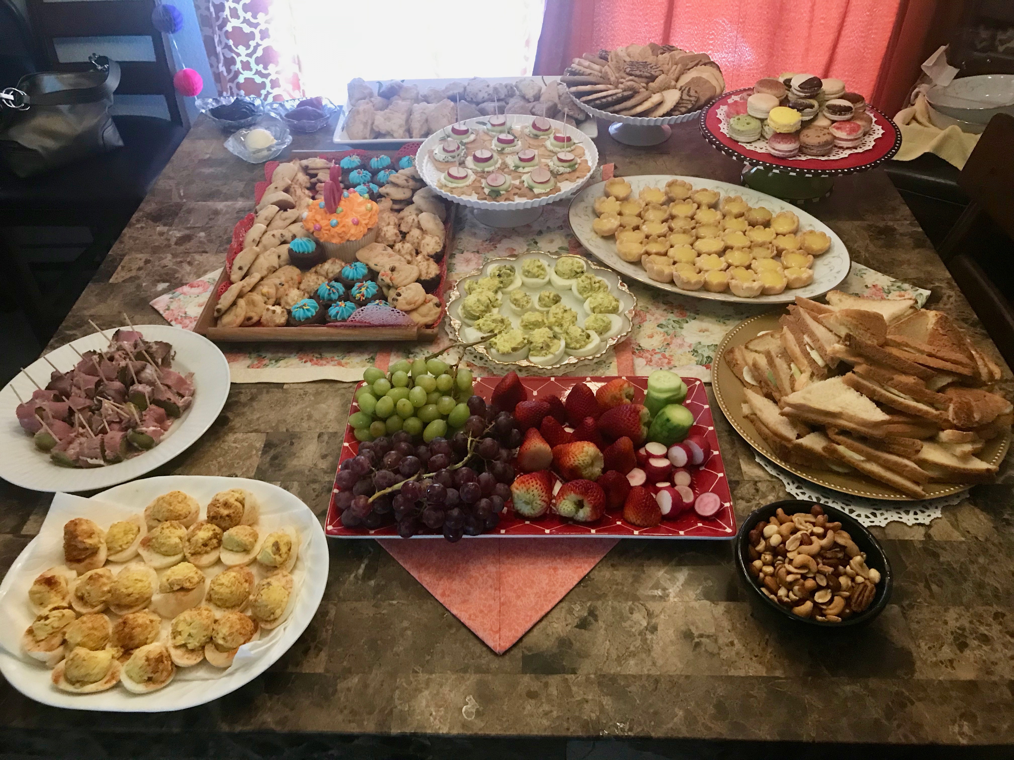
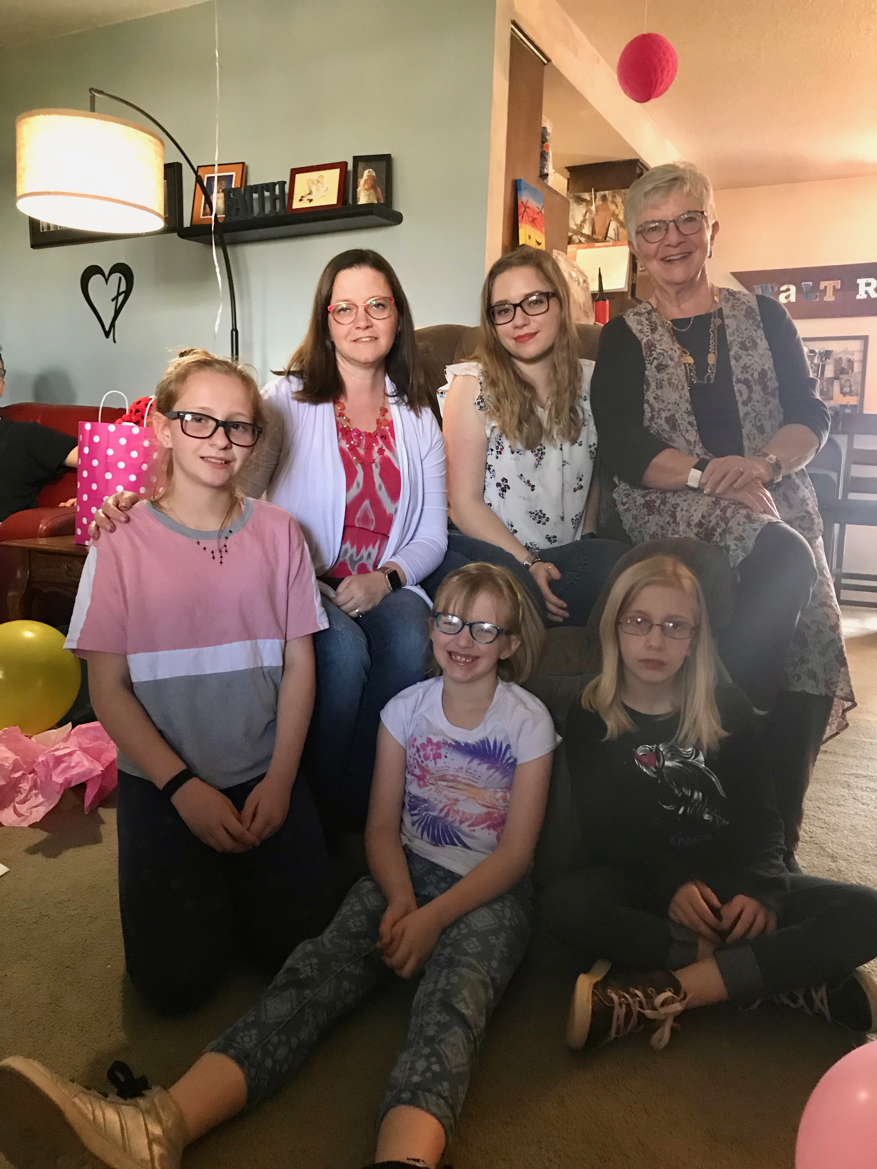
Her birthday isn’t until tomorrow but we celebrated it with her yesterday at the Walters’ home. Lydia requested a tea party which her Mom, Jennifer, happily provided. She’s happy she did it but commented that if someone asks her to do another one to make sure she says “no”. It was all beautiful and very tasty, including the avocado deviled eggs I made, with much encouragement.
So, it was scones, tea cakes, cucumber sandwiches, and tea, of course.
Lydia, surrounded by the family girls. Ceiarra should have been there, too, but she was in the kitchen. So all I got was Gilligan, Jennifer, Jerrie, Lydia, Diane, and Baylee
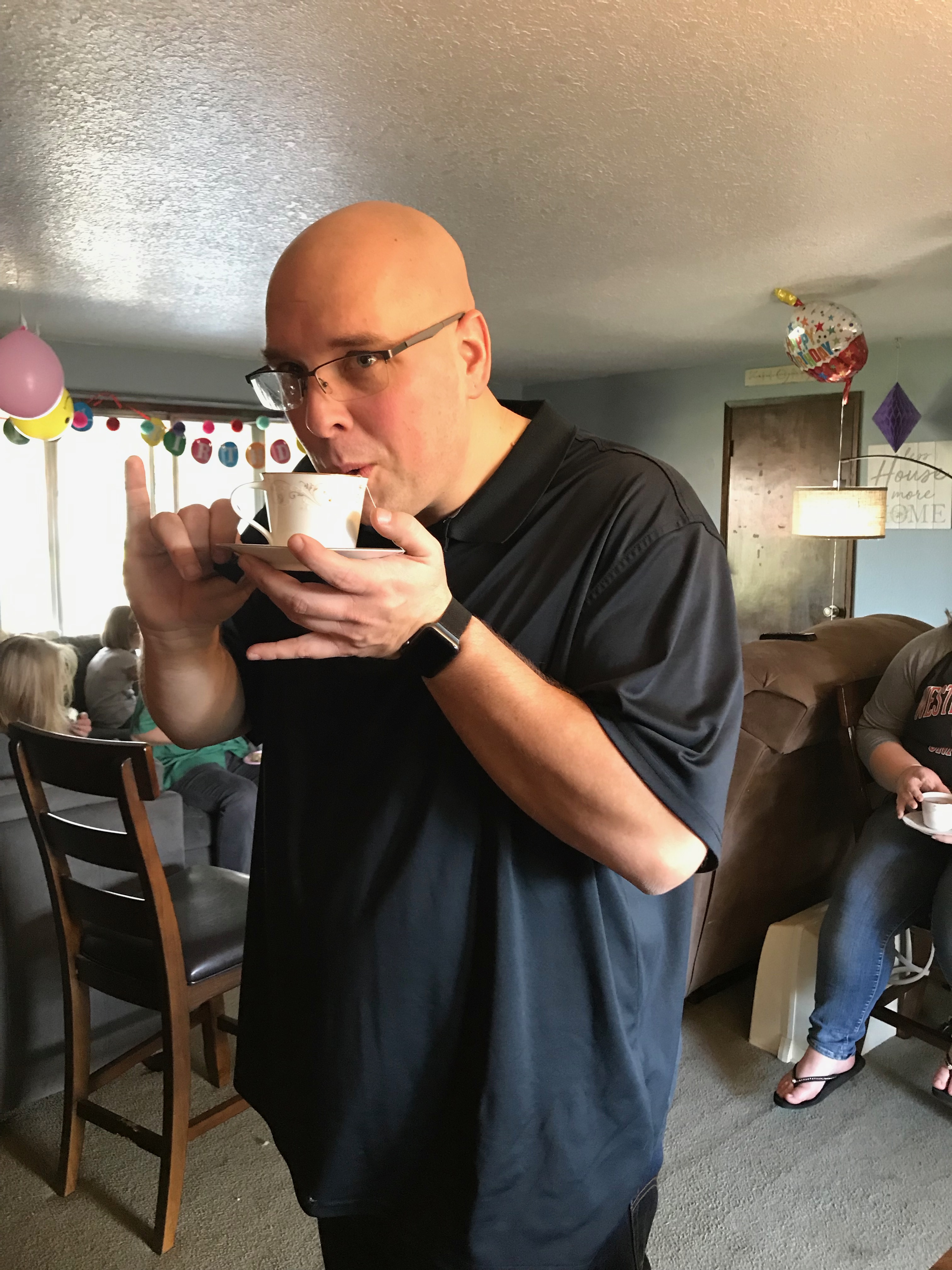
Daniel doing a great job drinking tea in the proper manner.