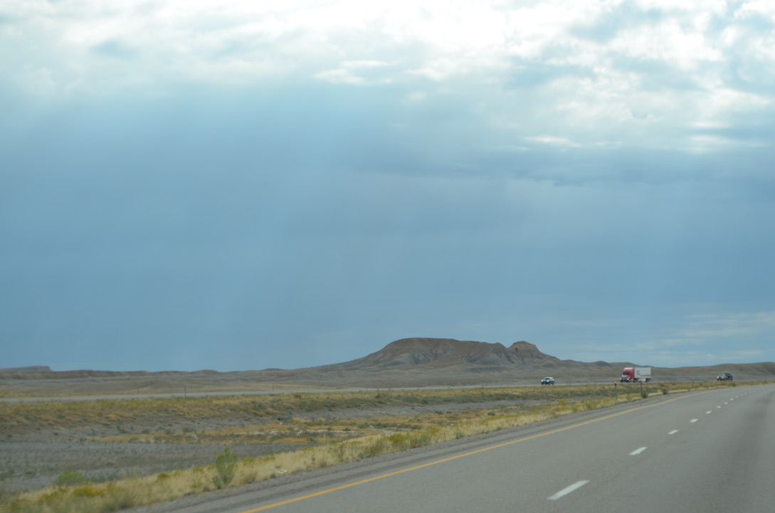
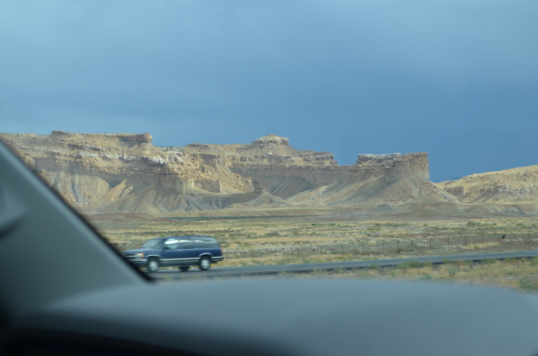
Beatty is a small town about 120 miles north of Las Vegas with a population of about 800 folks. Diane made a reservation for us to spend the night at the Space Station RV Park. There are a lot of free range donkeys in the area but I didn’t see even one of them so I didn’t take any photos of them.
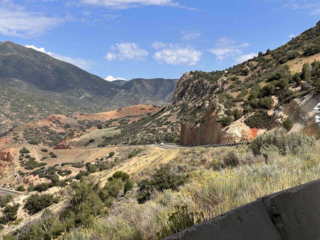
The drive getting here was up hill almost all the way making it tricky for me to keep the engine from overheating. I did well in the mountains by going real slow up the hills, much to the dismay of those behind us. There are many stretches of US-95 that run straight and true for many miles at a time which makes for a very boring trip. Boring except for the occasional gust of wind that blew us around a lot. It was pretty exciting at times. Thankfully, we made it without mishap, and I kept the “Check Engine” light off until the very last mile when we slowed down entering town.
I didn’t take any photos in Beatty because there isn’t much to see at the RV park. It’s pretty much a gravel lot along US-95 with defined spots for weary travelers, which we were.
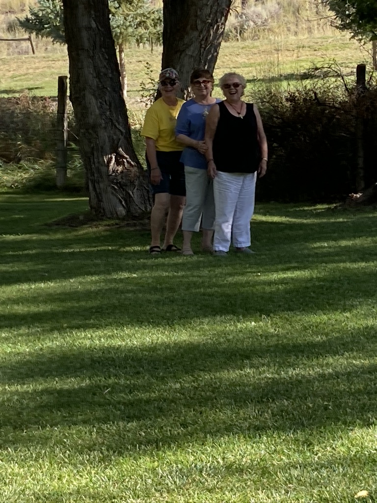
Since I didn’t take any photos of the town, here’s one from the 90’s . . . I think.
Diane’s Pops heavenly birthday was September 28th (he’s been gone since 2002).
The children are Lydia and Cedric Walters.
Next stop is NAS Fallon, Nevada, home of all the Top Gun pilots.
We left Beatty about 1030, right on time. Not the time we planned to leave, but it is what it is. Getting to NAS Fallon was an uphill drive the entire way. Seems like every direction in this part of the world is uphill, all the way. NAS, by the way, is an abbreviation for Naval Air Station. This particular NAS is a Top Gun training facility. Fighter jets are flying around every day, and they are loud. Diane calls all that noise “the sound of freedom.” I agree.
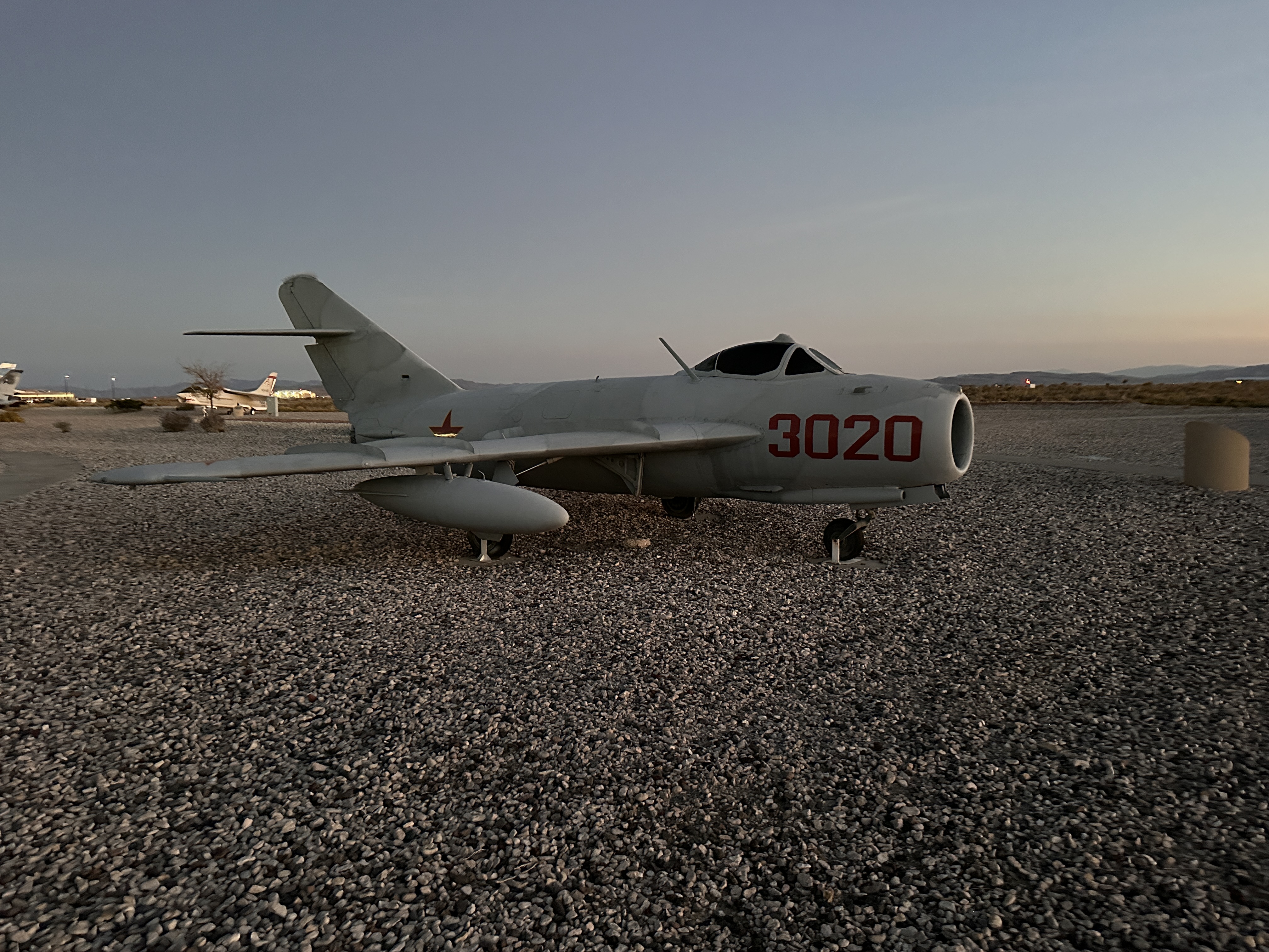
I didn’t get photos of the fighters during the day but did visit the flight line museum which is a static display of many aircraft, including Russian MIGs. But first, here’s an old COG plane that used to be on the USS Nimitz.
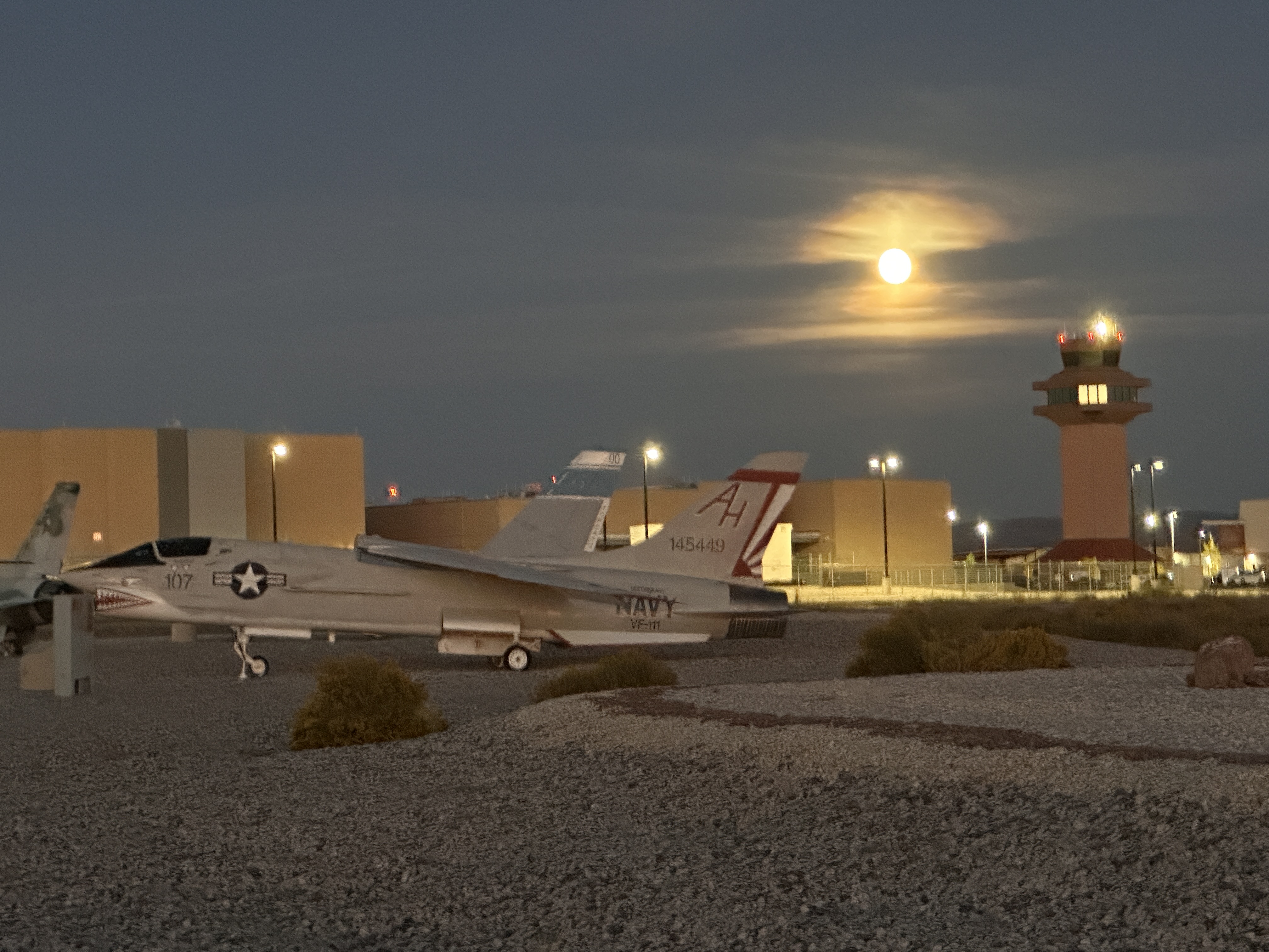
And lastly, here’s an American jet with the Super Moon in the background.
Actually, sometimes we went downhill, but not as often as uphill. During one of the downhill legs, I had to stop for a nap and some food prior to tackling the next uphill battle.
We got to the Fallon back gate at about 1500 and discovered it was closed. Nifty, right? Tried to turn around and got in a pickle. That means I was jackknifed and stuck. A Navy policeman magically appeared at my window and tried to help. Apparently, he and another sailor were manning the gate so they could open it when people like me showed up. Sadly, they didn’t get to the gate before I made a hasty decision to turn around without disconnecting the truck. As we worked, a local farmer stopped and also helped. He offered to go home and bring back one of his tractors so he could lift the back end of the truck and move it in line with the RV.
I couldn’t disconnect the tow bars so I disconnected the entire hitch but we couldn’t get it out of the receiver due to the pressure it was under. I had farmer get in truck and put it in reverse while I backed up the RV and the hitch came right out once we got to less than a 90 angle.
I’m sure you’re sad, like me, that no one took any photos of all that commotion so you’ll have to just let your imagination run wild.
We happily got on base, found the RV park, found the MWR office purely by luck and checked in. We found our space and I drove over the space marker while parking on the gravel which was next to a really nice patio. After some discussion, and observation Diane determined the RV was supposed to be on the patio, not the gravel. I reparked in the proper place, straightened up the space marker, and only had to adjust 4 times to allow room for electric, water, and sewer. What a day.
After all that was done, I hooked up the satellite dish and it wouldn’t work. don’t know the problem. I didn’t really care right then so did a search for over the air channels and got a bunch, but the signal wasn’t very good. Diane watched them anyway. We were just happy to be there.
The next day I found a screwdriver and dismantled the satellite antenna to see if something fell apart inside. I was curious what it looked like anyway, so it didn’t really matter if it was OK. I also checked the cable using a continuity check with my little handy meter. About the time I was ready to go out and get a replacement system, I did one more check on the small cable that connects the Satellite receiver to the internal line from the antenna and found it to be faulty. I replaced it and the system worked perfectly. All the while I was working on this, Diane was nearby doing laundry. It was hard to pass it up because it was free. She was a happy camper. Happier, even, when she learned that the satellite worked again. She got even happier, if possible, when I drove into town, all by myself, to get a haircut.
Life is good when you can be happy over small things like that.
Since returning to St. George from Surprise, it’s been nice just not doing much of anything except walk Max 2-6 times a day. And eat stuff. Thinking we should do something else, we decided to take a trip to Zion. We didn’t stop on the way past when getting to this neck of the woods although one of our goals was to see all of the national parks in Utah. Skipping Zion wasn’t in the plan because we really just didn’t want to do anything but sit around. And eat stuff.
Then the light clicked after a couple of idle days and Diane suggested we should go there and wondered what I thought. Not usually being the one who had an opportunity to direct the course of our day, I was at a loss for words. Silence prevailed as my mind whirled because of this uncommon event. I apparently blacked out right then and must have uttered a convincing “OK” because when my senses returned Diane was busy making sandwiches for the trip.
So, we went to Zion.
It was a good choice. The only negative aspect of the trip was a repeat of the first time we visited Zion back in the 70’s; there was absolutely no place to park at the visitor center and all the roads were lined on both sides with people parked illegally. Diane made a few passes through the parking lots we encountered but every spot was filled. So, we headed deeper into the park to see what we could from the car. OK. It’s a truck. We drive a truck. I’m not sure why we call it a car. Doesn’t make sense, does it?
As we climbed the walls of the canyon, headed for the only way out, Diane spied an empty spot where she could stop the truck on the edge of a very steep cliff that was totally out of the oncoming traffic lane. Max was happy about that.
I had the forethought to ensure we had foldable chairs in the truck so we were able to sit on the edge of this cliff while we ate our sandwiches. It was actually very nice there nibbling on our sandwiches, looking at the incredible scenery right in front of us. I took lots of photos and will stick them in here when I find them. I think I may have solved the mystery of how to extract photos from my iPhone and plant them somewhere in the memory of my new Windows computer.
It’s not really a Windows Computer. It’s a Hewlett Packard computer that runs Windows 11 and it’s a real challenge for me. For the past 13 years I’ve been using an Apple computer to do this stuff but, as previously reported, it failed me just because I accidentally spilled a little milk on the keyboard. OK, I spilled most of a cup of milk on the keyboard. It was a mess and the old laptop decided to punish me by disallowing random keys to work properly. It’s kinda hard to write coherent sentences when the “m”, “6”, and “7” keys won’t do anything. I realize that just those three keys shouldn’t have caused me so much grief but when I’m typing at a good clip and hit one of them, and they don’t work, I get frustrated and totally lose my train of thought. The only solution was to shun my Apple computer and replace it with a Windows unit about which I knew very little. It was a challenge I couldn’t refuse. It made sense at the time.
Anyway, I fiddled with Apple vs. Windows protocol until I coaxed a few photos to migrate from my phone to the -new computer. Seeing that happen made me happy so I went to other areas of my multitasking computer and just let the photos run. After a while I got curious about the photos progression and checked. The migration was up to over 20K photos and only 60K to go. Yes, I have over 80K photos on my iPhone. Makes me curious, too. Why in the world does anyone need to have that many photos on their phone? The only reason I can think of is it’s an obsession. I’m a sick puppy and need help figuring this out. Maybe it’s not an obsession because I spend time looking at old photos. It’s enjoyable to see what our kids looked like 40-50 years ago.
Sorry about that detour.
Zion was beautiful, even if it was seen from a moving car. We drove all the way to the top, through the 1+ mile long tunnel that was carved through the edge of a mountain. We drove it that first visit, too, but it was from the top down. Very creepy. When we got to the top, and computed how far we’d have to go to get back to the RV, Diane turned around and we got in the line to go back through the tunnel. We were second in line when the line started and learned that an ambulance was on its way to rescue an injured hiker.
When the ambulance arrived we were allowed to head on down so we could return ‘home’. We stopped in Hurricane so Max could run free in a nice dog park they have. It’s really nice and he had a great time. Only one other dog showed up to play with him and he ignored her. Spent pretty much all his time smelling every inch of fencing, every rock and tree, and bush instead. Making friends wasn’t on his itinerary.
Once back to St. George, we stopped at a pizza joint and got a pizza for dinner. Diane did a marvelous job of squeezing that truck into a small parking place, then unsqueezing it to get back on the road. Pretty tricky. Makes me proud.
Now it’s bedtime. We leave in the morning and plan to spend tomorrow night in Beatty, Nevada.
Yesterday we spent a little over 6 hours driving to Surprise to visit Jack and his Arizona family. We took turns driving 2 hours stints and it went well. We arrived at our designated Hampton Inn on Grand Blvd late afternoon, a couple of miles from Jack’s home. We were tired so deferred first contact to this morning which worked for Jack.
After waking around 0700 I walked Max then grabbed a cup of coffee for Diane and headed back to the room. We got ourselves ready for the trip then stopped by the breakfast nook for sustenance before heading to Happy Trails. Jack met us at the gate and got us a pass so we could come and go at will which Diane did. Before she left we had lunch at the activity center; Diane had a patty melt, Jack had a quesadilla, and I had a few dead shrimp. It was all good. Then Diane went off to a nearby Dollar Store for some essentials and I stayed at the house working on a jigsaw puzzle with Jack. I think I found only about 3 pieces, but it was productive. We talked a lot.
Later in the afternoon we returned to the hotel so I could get my evening pills then stopped by Albertsons where Diane picked up some dead chicken and a salad for supper. When we got back to Jack’s, Brian, Annie, and Kelly had just arrived so we foolishly stayed outside for a while just talking, until the mosquitoes got busy and forced us to go inside. It was really great to visit with the family.
For a while we weren’t sure we’d be able to visit with Brian because he had a medical emergency the previous evening that made walking difficult. He spent the night in the hospital. But, he was able to come visit. We felt special that the whole family came to see us.
Alas, the visit had to end, and everyone went home. Well, everyone went home except Diane, Max and me. We went back to our hotel with a plan to return the next morning.
So, that’s what we did. After a restful night’s sleep, we went back to Jack’s around 0900 and loaded up a few things he wanted us to transport to St. Helens. That didn’t take long then we were on our way. It was a solemn goodbye because we’re both old and we’re never sure we’ll see each other again. That would be true, too, even if we were still young. Being old makes that possibility more likely.
At the time I’m writing this we are 48 miles from Flagstaff, going north on I-17. It’s been mostly a quick trip but we’re going the long way through Flagstaff. From Flagstaff we worked our way along the north side of the Grand Canyon heading mostly west. The scenery was really beautiful, when we could see it. For a majority of that portion of the trip it poured rain in astounding quantities. It was almost like being home in Oregon.
In case you were wondering, we skipped I-15 from the Phoenix because, as roads go, it really sucks. It’s horrible. I-17, on the other hand, is way better. It’s longer but a much better ride, and I wasn’t driving so it was OK.
Now, for some exciting news! On this trip Diane set a new record for non-stop long-distance driving. Our trip from Surprise to St. George going down was 6.5 hours long, or something like that. Taking I-17 moved us north through Flagstaff and past the eastern edge of the Grand Canyon which made it a little longer for the return. We left at 0950 and got to our RV just after sunset around 1930. Disregarding hours lost, or gained, due to time zone changes, that works out to almost 10 hours. We stopped for about an hour for lunch, so call it 9 hours. Diane’s record is that she drove every minute of it without running off the road even one time. She even managed to get the truck up to 103 mph once while passing a couple of cars that weren’t pleasing her in the way they couldn’t maintain a constant speed in the vicinity of posted speed limit that varied from 65 to 80 mph.
Now, we’re back in St. George and everything is still in place. The only thing I had to do was figure out why we didn’t have water pressure in the rig. I didn’t mention that before, did I? Well, Diane took a shower and said the water pressure was so pitiful that it was like getting wet and rinsed with a squirt gun. An old squirt gun. I fixed it by removing the pressure restrictor from the input line. Now we have great pressure and the water lines don’t seem to be in any danger of blowing out. If that proves to be untrue, I’ll publish a retraction. Now I can take a shower and be confident the pressure will be enough to get all the soap off. I might even wash my hair. Haven’t done that in a while.
I think I mentioned in the last post that we went to Panguich to a NAPA store to get a new radiator cap for the motorhome. I also got some antifreeze to replace part of what was lost when the radiator erupted and eliminated about 5 gallons of boiling antifreeze and water onto parts of my body and all over Diane’s truck. Had I been standing a little further away from the action I might have enjoyed the spectacle. I’m sure it was something to see. Anyway, we got the new cap, got a Subway sandwich and ate it in a small park along whatever road we were on, let Max run free on the grass in that same park, then headed back to Cannonville. It was a fun and relaxful drive. Yes, relaxful, is really a word even if I just made it up.
Once back at camp I added one of the two gallons of antifreeze to the RV and installed the new cap. The gal at NAPA looked up the RV by VIN and sold me a 16 lb cap. The one that was on it was 9 lb.
Then, yesterday we broke camp and headed down the road. I use the word “down” loosely because there isn’t much down in Utah. Pretty much every road we traversed was uphill. Little did we know that the worst was yet to come.
The very first large mountain we encountered caused the RV to overheat, but it took a long time for that to happen. We almost made it to the top before the light came on and went right out when I used Terry’s advice to slow way down. It worked. From then on we made it the rest of the way with no incident even though we went all the way up to 9600 feet. I have to admit that I was holding my breath quite often on the way up those mountains, but we finally made it to I-15 South to St. George. To celebrate that feat we stopped for lunch on a handy pullout on the on ramp to the freeway. I even took Max for a celebratory walk. Once that was done we joined the 80 mph traffic as we trundled along at our chosen speed of 60 mph. Surprisingly, quite a few joined us and no one tried to push us off the road. It was an uneventful trip, all the way to Temple View RV Park on I-15. I was happy to learn that our assigned spot was about 30 feet from the check in office. How handy is that? The spots are very nicely laid out. The RV goes on one side of the patio and the towed car on the other side. Really handy. I have photos but can’t add them until I figure out how to transfer them from my phone to the new computer.
Oh, ya! I got a new computer. This morning we drove up to Best Buy in Washington, Utah and fixed the problem I created when I poured a cup of milk on my MacBook. Kinda a dumb thing to do, right? It was one of many dumb accidents I’ve experienced over my lifetime. I actually think I can rectify the problem, however, because I have another MacBook at home that works, but no one can log in to it. No one remembers the user name or password. So, I’ll tear them both apart and see about swapping keyboards. That will be the topic of another post one of these days. Until then I’ll be busy learning how Windows 11 works. It’s been a long time since I’ve had to use a Windows computer so it’s a challenge. It types nice which was my prime concern.
Tomorrow we plan to leave here early for a pickup ride to Surprise, AZ, 6 hours long. We’re going to stay 2 days so we can make the 6-hour drive back to the RV. I told Max about the pending trip and he wasn’t happy. I took the above photo to document his displeasure. I think it’s evident he’d rather to to a water park, or just a nice green field of grass. He loves grass fields to run in.
This morning (9/21) we got up early at 0700 and left the RV around 0900 and headed south. The trip took us through Las Vegas which wasn’t pretty. There’s a very LA smoggy layer of air hanging over the city making it totally unattractive. I took a photo but won’t add it because I don’t want spoil any good thoughts you might have about LV. Also, I still don’t have a workable solution for making photos available to the new laptop. The above photo was made available via some magical set of circumstances that I’ve been unable to replicate. It’s a mystery I need to resolve.
We’re in Surprise, AZ right now and I’ve talked with my brother Jack alerting him that we will connect tomorrow. The drive down wore us both out. Max, too.
Now, for supper. Then I’ll maybe get to work on that mystery a little before slumber overtakes me.
Left Green River around 2:30 pm. Arrived in Loa around 6:30 pm. There was a dispute are our arrival time because we were heading west, and we had conflicting information from all the clocks available to us. Since there was a dispute, I tossed a yellow flag and made a judgement call. We arrived at 6:30 pm. Normally it’s a 2-hour trip but we did it in 4. I think that a new record. I blame it on the GPS for getting us heading in all the wrong directions. Took a couple of stops to figure it out. The last one took us from 1.5 hours to our destination, down to less than an hour. What a trip, but we saw some incredible country because of the error.
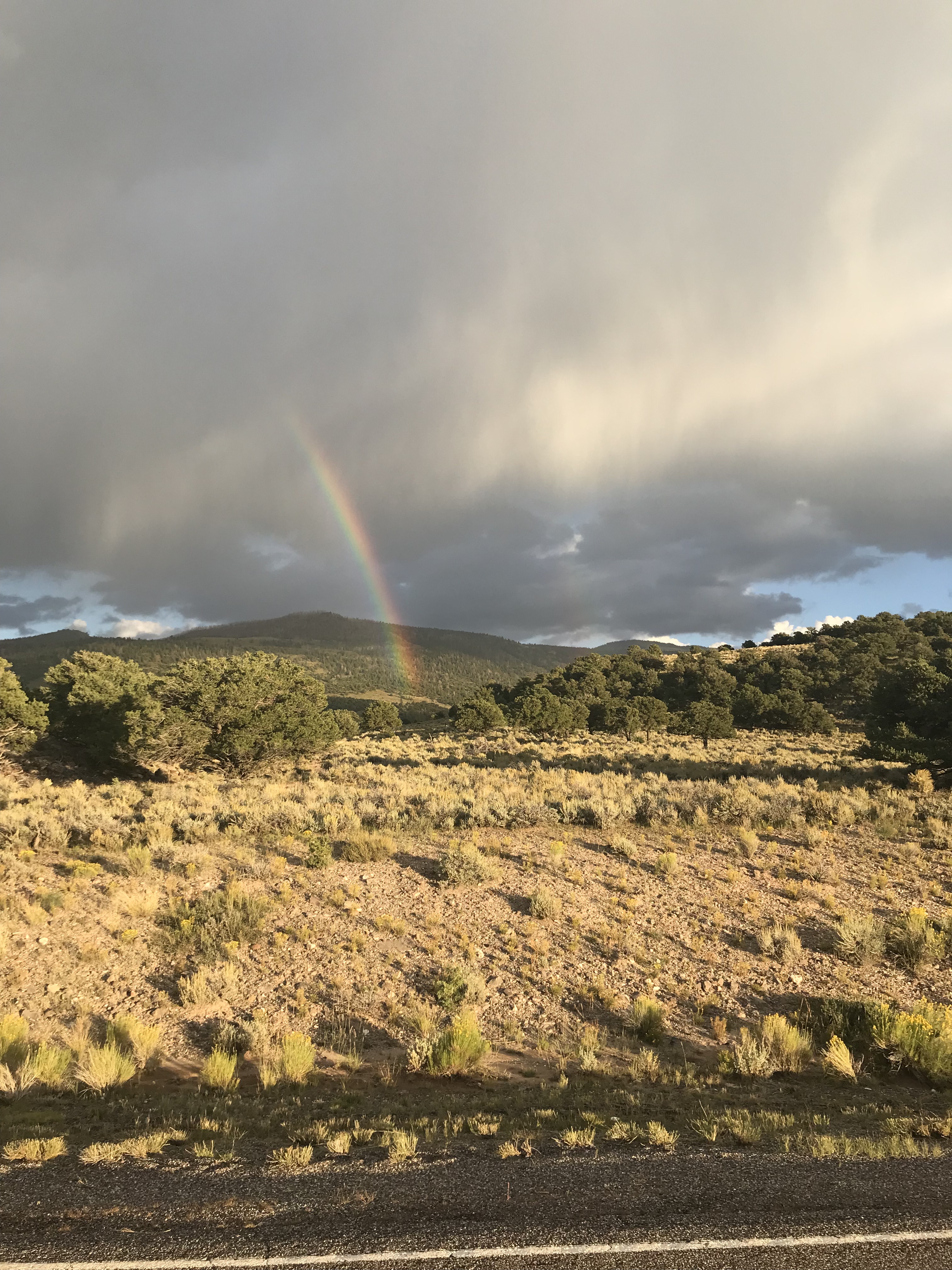
Upon our arrival we were blessed with rainbows and an excellent view of a cometC/2022 E3 (ZTF).
Getting to Loa with our trucker GPS made it a long day because we were directed away from I-70 due to construction and routed too far north for everyone’s comfort. Diane called the RV park at our destination and got good info for a faster way to get there. In the end, everyone was happy to be in Loa. Gary, the owner of Fremont RV Park met us as we drove in and directed us to our assigned spots. He saw us coming because he lives just across the street from the RV park. Pretty handy.
Diane and I slept well in the cooler air. Loa is just over 7,000 feet elevation which meant we were in for a much cooler night. Matter of fact, it downright cold the next morning. didn’t get a temperature, but my body let me know it was cold even though I didn’t wake up until 8:45 am.
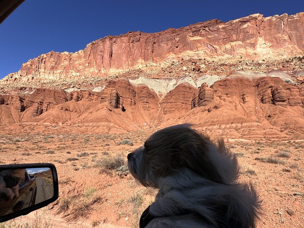
We fiddled around pretty much all morning then saddled up and headed to Capitol Reef National Park. It was pretty awesome. We didn’t drive down every road but saw enough to make the trip worthwhile. I have hundreds of photos of rocks, hills, and mesas.
On the way to the park is a small village called Torrey where we stopped at a knick knack store that had a front yard crammed full of interesting items. Diane was going to get a whirligig thing but changed her mind when she learned that all the stuff is from Mexico. That’s not a bad thing. She was more interested in things made locally.
This first one is for all the kids in the family:
This next photo, though probably not appropriate, has a story. While walking to this building we had to walk along a very fast-moving irrigation canal. Not a big one, about 3 feet across, and it looked to be about 3-4 feet deep. Hard to tell because the water is the same color as all the hills surrounding the town – the color of Max’s ears. Grass grows right up to the edge and the water is about a foot below the ground and there is no gradual slope on which to rest tired little dog feet. So, Max must have marched to the water thinking he might get a drink and took a header into the water. I wasn’t aware of this until I felt some strange tugging on his leash. I was talking to someone. When I turned to see what the commotion was there was little Max struggling to get out of the water, but he couldn’t quite make it. He was wearing his harness, so it was easy to pick him up with the leash and put him on high ground. I know, I should have taken a photo, but was more concerned with getting him out of the water. He was a happy camper and shook most of the water off very quickly. There’s something about his fur that repels water so he dries fast. The below photo is simply a representation of how that little event scared the crap out of him. Yes, I cleaned it up.
Now for some random photos I took while Diane buzzed around some roads in Capitol Reef.
I don’t know who that is in the below photo. I just needed a photo of the sign because I kinda cut it off in the following photo of our group. Some of you know these guys.
This pile of rocks is called “The Castle”.
Max really enjoyed the trip and riding with his head out the window helped dry him off. Diane said he smelled terrible, but I couldn’t tell. He smelled fine to me but then, I eat stuff I’ve dropped on the floor.
I love this big gnarly. It resides in an orchard of various kinds of fruit that were planted by early residents of the space. Anyone riding through can stop and pick fruit. There is a cost, but I don’t know what it is. Lots of people stopped to partake. The area is called Fruita. I read somewhere along the line how that name came from but darned if I can remember it.
I have to stop this now because for some reason I poured milk on my laptop keyboard and that didn’t go well. After pouring the milk off I dried it as best I could but some keys are rebelling, failing to function. Specifically, the 6 and 7 keys don’t work and neither does the “m” key. Turns out that those particular keys aware absolutely necessary for some passwords and words like mumble, mommy, for example.
I know you are wondering how I can possibly continue as I am obviously doing right now. We’ll, I’m finishing this up on my iPad. I could continue but there would be no photos. We’re going shopping tomorrow to rectify my interlude with that glass of milk.
Tip, next is our trip from Cannonville to St. George and some minor maintenance on the RV.
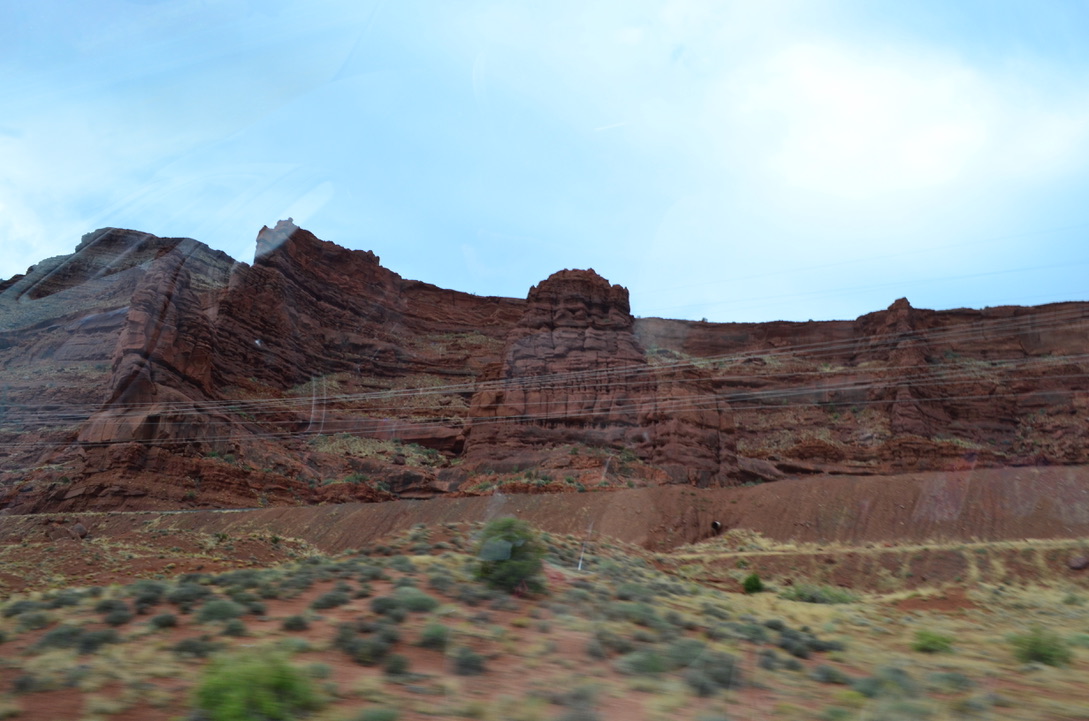
This morning we packed a couple of sandwiches (that I made), gathered up the dog, and headed for Canyonlands. The entrance to this park is down the same road as Arches, but it’s farther from Moab and on the right instead of the left of Highway 191. That’s my kind of exit. I’m kind of anal about NOT crossing oncoming traffic lanes to view “something” because getting back on the road could be problematic and fraught with danger. If it’s right turn, I’m good to go. Getting back on the road safely is solved by going to a traffic light and waiting for everyone on your left to stop and let you out. Simple and safe.
Unlike Arches, the Canyonland entrance is much further off the road. Arches is like, right there, as soon as you exit Highway 191. And it’s a right turn! Apparently, that’s the reason Arches requires entrance passes because the traffic would quickly back up, blocking Highway 191, keeping people who had already seen Arches from getting to lunch in Moab. Backing up traffic to enter Canyonland isn’t an issue. The backup could be miles long and wouldn’t interfere with folks going to lunch in Moab.
Thankfully, there was no long line of cars entering the park, so we sailed right through the gate. Just zipped right past the ranger as if she didn’t know we were there. excerpt, she gave us maps and told us some rules about parking ONLY in designated area, like between the lines. Turns out that about half the visitors ignore that rule.
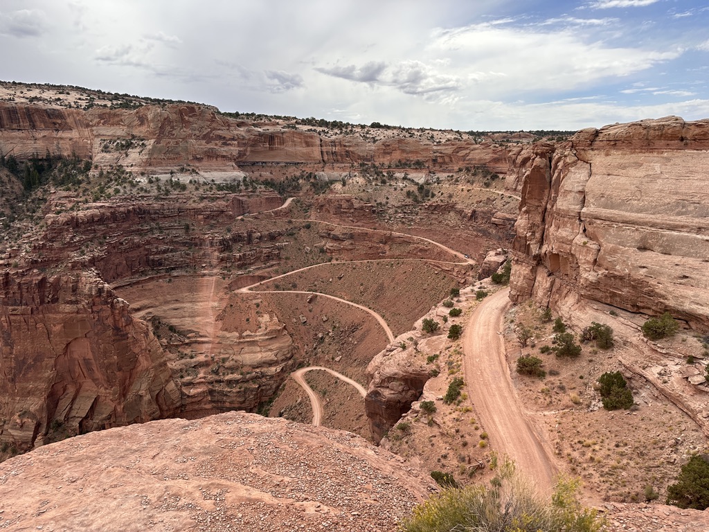
Although the views from our vehicle were stunning, some of the more interesting views required long walks. I did 3 or 4 of them and logged over 5 miles on my Fitbit. I got many photos to prove my prowess. I also have tender legs and a sore back from hiking up hills and down gullies. It was fun, though. Most of the time I was alone in the wilderness because I chose to follow Robert Frost down the paths least traveled. None of my fellow travelers knew where I was so it was a bit exciting until I got to the part in my head where it said, “if I collapse, or fall down out here, I wonder how long it would take to find me?” It wasn’t something that concerned me. It was just a curiosity.
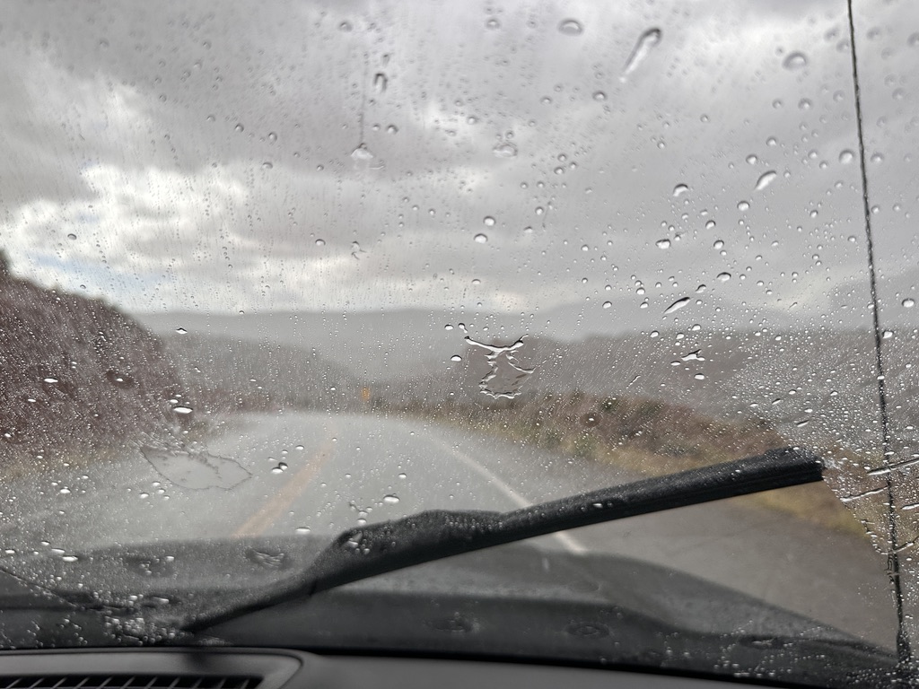
After seeing what we wanted to see we headed for the exit and were greeted by a tremendous thunderstorm that washed all the dust off the truck. The water running off the mesas did so in the form of impromptu water falls that was quite nice. It was a demonstration of how the surfaces of the plateaus are so smooth. I tried to get photos, but it was raining too hard to get the camera focused through the rapid swipe of the windshield wipers, and there was no way I was going to roll down my window.
Before we left for this day’s travel, Diane broke out the crock pot and started the base for tortellini soup. I chopped up the vegetables she needed. The pot was on low so cooked nicely while we were gone. Upon return from our journey, she added the tortellini’s while I did something else. Don’t remember what it was, but I did something.
Then we gathered at the Unger’s residence for a nice dinner on their patio. The rain was long gone, and the temperature was just perfect of us Oregonians. The soup was so awesome that I plan to have more for lunch before we pull the plug on this location and head for Loa, Utah, our next stop on this adventure.
Now for some photos.
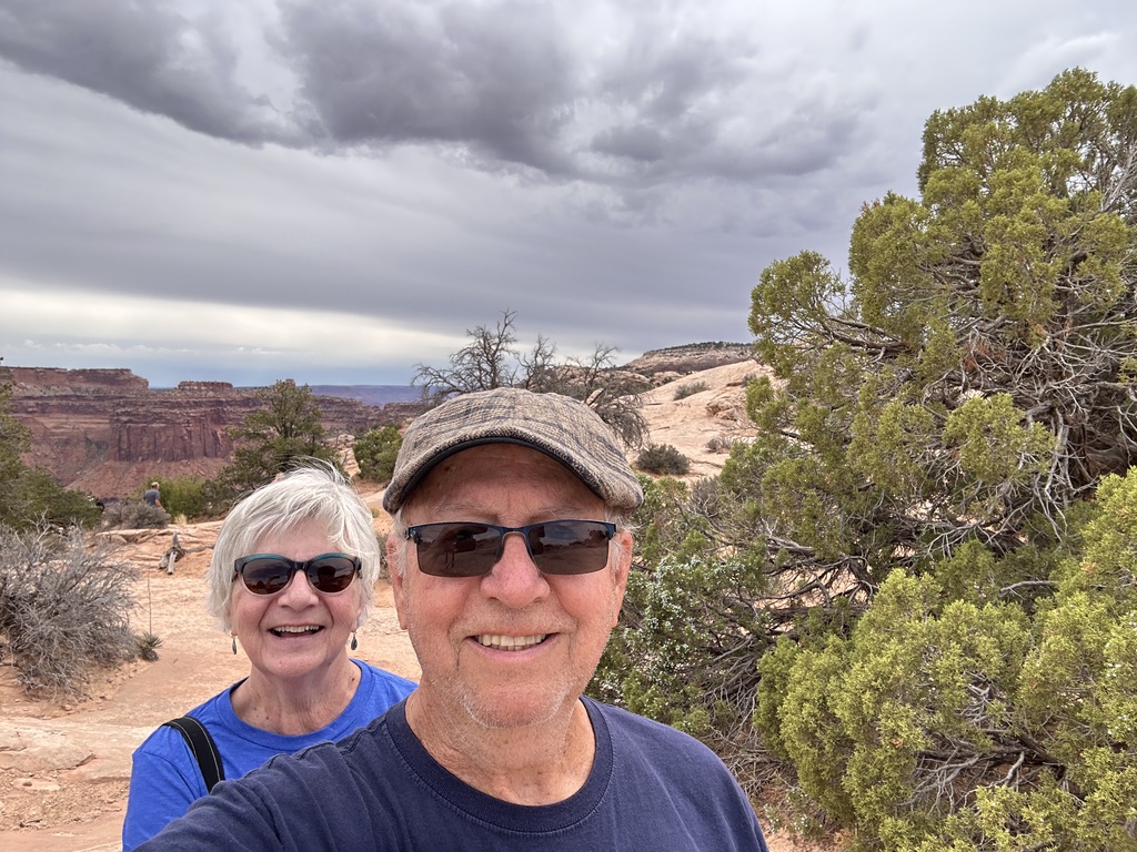
This is us . . .
This was my first walk. I don’t know what it’s called but, oddly enough, it sits on the edge or a deep canyon.
The un-named rock up close . . .
I got close to the left side discovered that it’s a long way down with no barrier to keep uncareful people from falling off. So, I went back to the truck. It was more safe there.
A little further away is this view of a dirt road that daring people are invited to take to the bottom of the canyon, 1400 feet away, and drive all over in the canyons. Looked fun but Diane didn’t want to do it. Had she agreed she would have had to tell me later how it went.
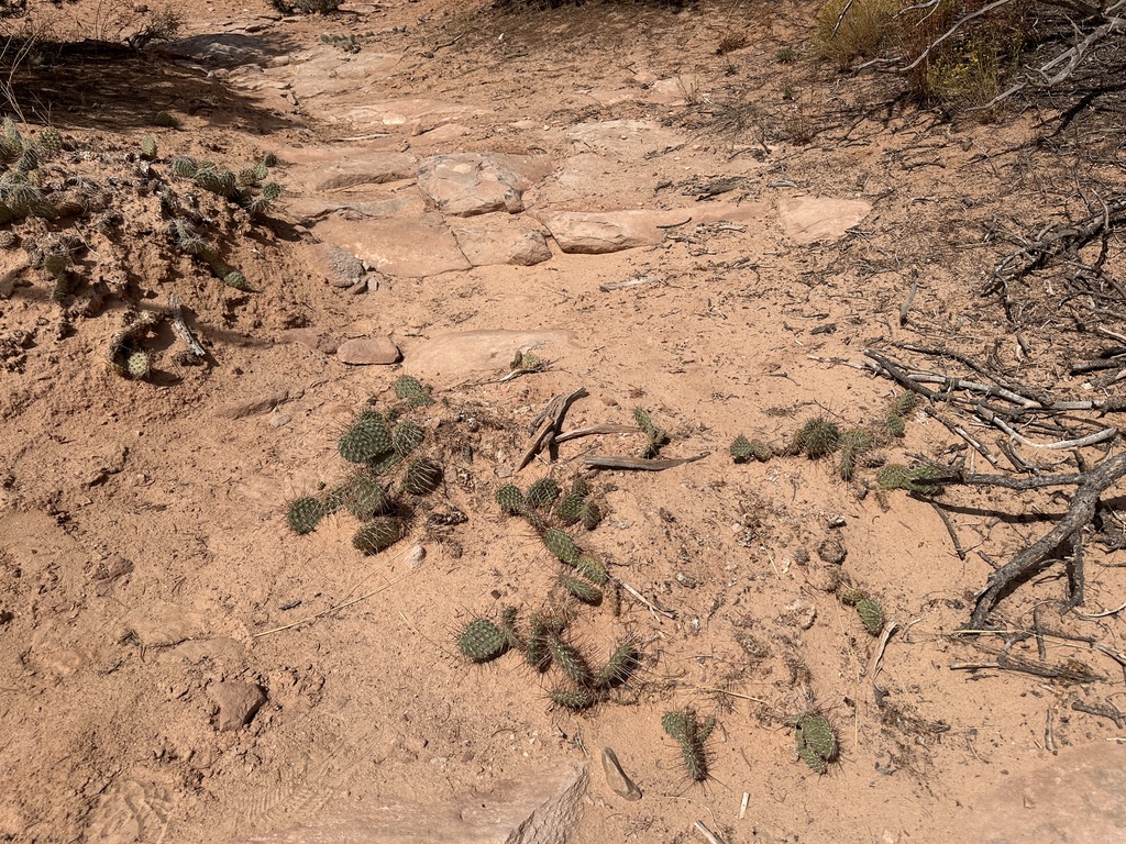
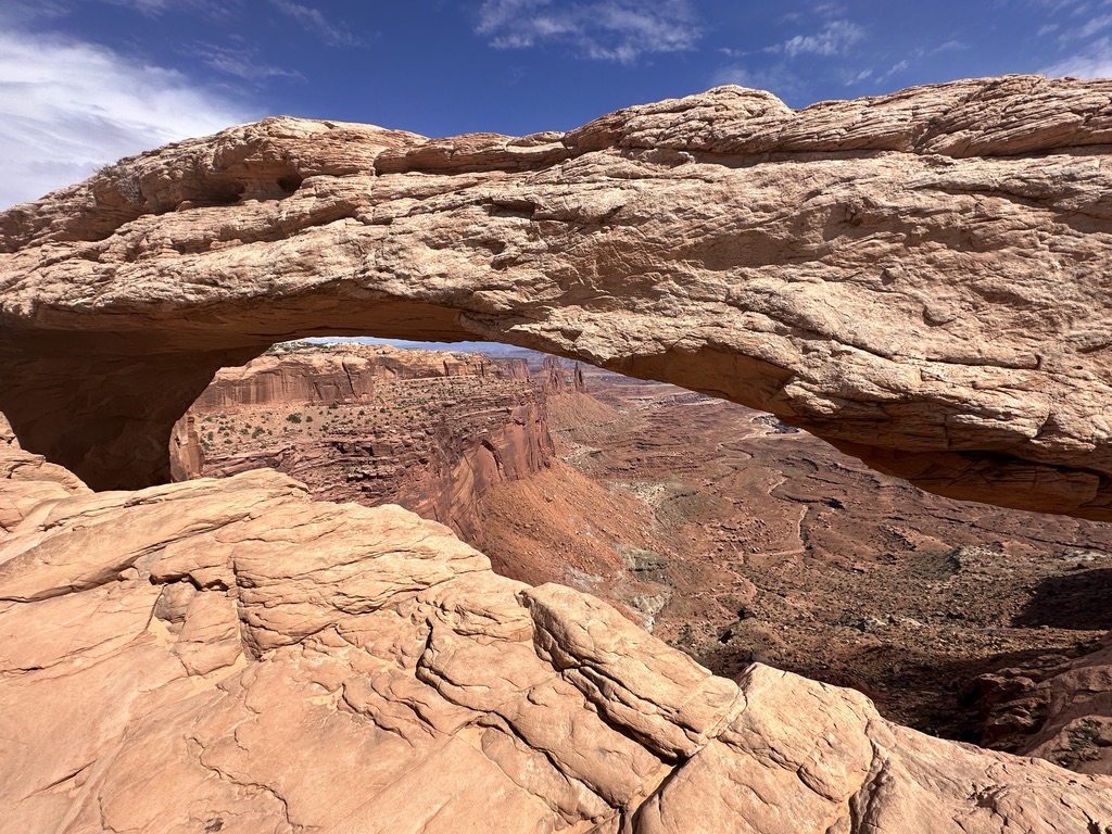
Driving on we encountered a trail to Mesa Arch. Feeling frisky I decided to see what it was like and what Mesa Arch actually looked like. Prickly pears were abundant.
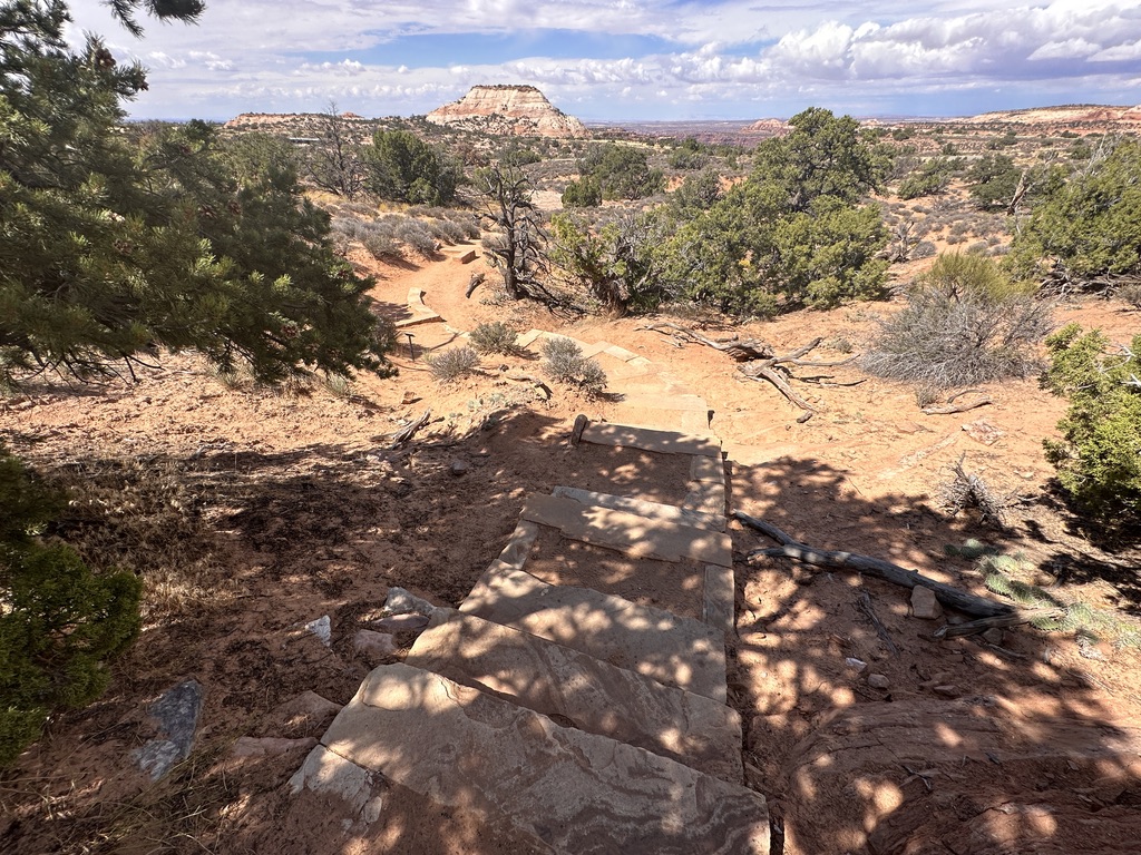
The trail went ever upward with large slabs of stone steps on the steepest. Each step is composed of three pieces of stone about the size of a railroad ties. Sand in the area fills the space between the pieces. It’s evident that many people choose to talk around them. Me? I used them. There were literally hundreds of these steps. Making them must have taken a considerable amount of time.
I finally made it to Mesa Arch. Many people were standing around talking and taking in the view, so I took this picture.
It doesn’t look like much until you get closer where you can see how it frames the vast area below.
Then I went back to the truck, but I did it by continuing on around the formation that leads to Mesa Arch. On that part of the trek I didn’t encounter even one other human being. More than once it crossed my mind that if I fell down, for any reason, I might be laying there for some time before someone found me. It made me more careful than I normally am.
I made it out safely and we wandered around a bit before heading back to camp. Before we made it back to the park entrance, we were blessed with a tremendous thunderstorm that made it necessary to see if our windshield wipers still worked. It came on slowly, then blossomed into something to behold. It was kind of nice, it was.
Once we got away from the park we were out of the rain, and it was smooth sailing back to Green River.
After a restful night we woke to the prospect of seeing the wonder of Arches National Park. It’s about a 40-mile trip from our RV park but it was a nice drive. We even got rained on part of the way. That was refreshing for us wandering Oregonians. It didn’t last long, though.
When we got to the Arches entrance, we were confronted with a dilemma we hadn’t anticipated, nor had we been forewarned. It turns out that Arches is one of 6 or 7 national parks in the USA that requires folks to get a reservation for a specific entry time. We there were vague instructions about how to obtain one. It included a phone number but I went to work on the proffered web site thinking I could figure it out. Turns out I couldn’t and missed the 2 pm entry slot. Then I called the number and got permission to enter at 3 pm. So, having time on our hands, we went to Moab for lunch. We were with Cliff and Susie because they missed the 2 pm slot, also. Carolann and Terry got in at 2 pm so we had to split up. It worked out OK in the end.
Lunch was a cheeseburger for me and dead fish for Diane. Hers looked really good but I refrained from begging for a bite. She finally offered a bit to me but I opted out and just ate my cheeseburger. It was good, too. We ate outside so Max could sit with us and not have to stay in the truck. He got a lot of attention in many different languages from people who live all over the planet. Moab is a busy, busy place. You should all visit this place at least once. I didn’t take many photos in town because I was enthralled by the scenery that surrounds the town. They do have some interesting street signs and apparently there are wires inlaid in their roads that allow everyone to drive hands free. Diane tried it out and it worked great until we got to a corner.
I have a photo of the street sign on my phone and it will be made accessible at a later date. Just trust me.
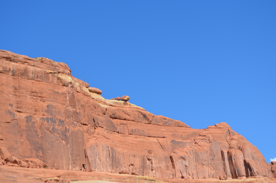
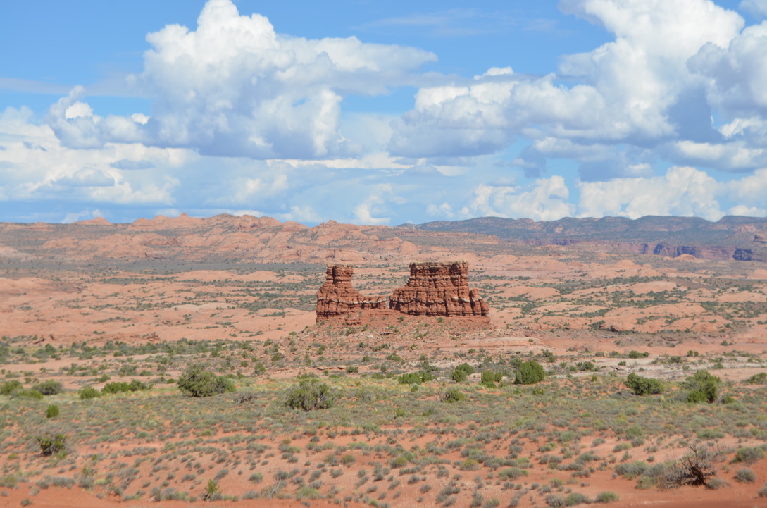
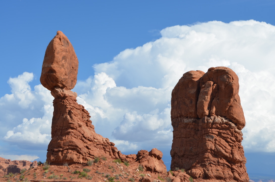
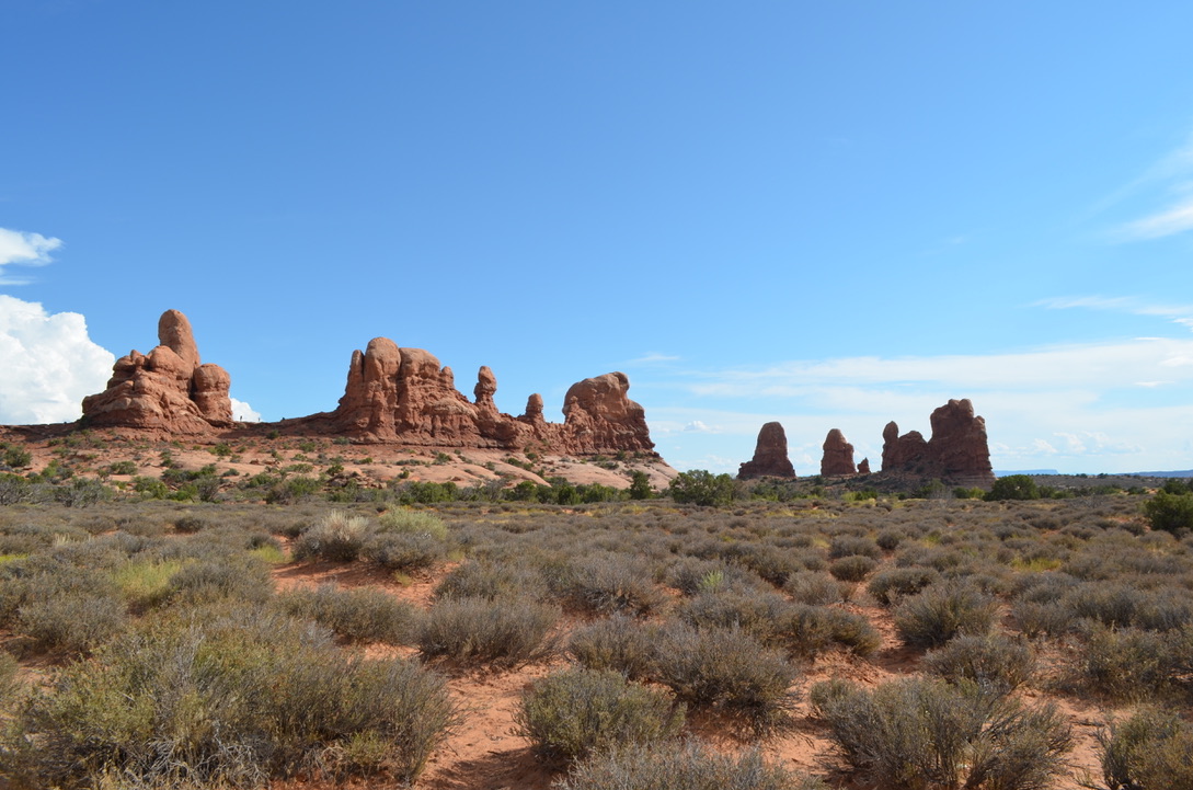
After lunch we returned to Arches and spent 2.5 hours driving through awe inspiring rock formations. I only took 193 photos, some of which I will add shortly. First, however, since pretty much everyone in the world has seen the sculptured arches at some point in their lives, I won’t dwell on them. We didn’t even get very close to the real thing, but we got within a mile or so and took a pretty good photo, if I do say so myself. I’ll just toss a few of them out here for you to ponder. After finishing Arches, we returned to our RV, had supper with our friends, then called it a day.
On the way to Arches the landscape started changing from flat to lumpy . . .
By the time we entered the park at 3 pm the threat of rain had passed, and we enjoyed beautiful weather . . . Max didn’t care . . .
Then things got interesting . . .
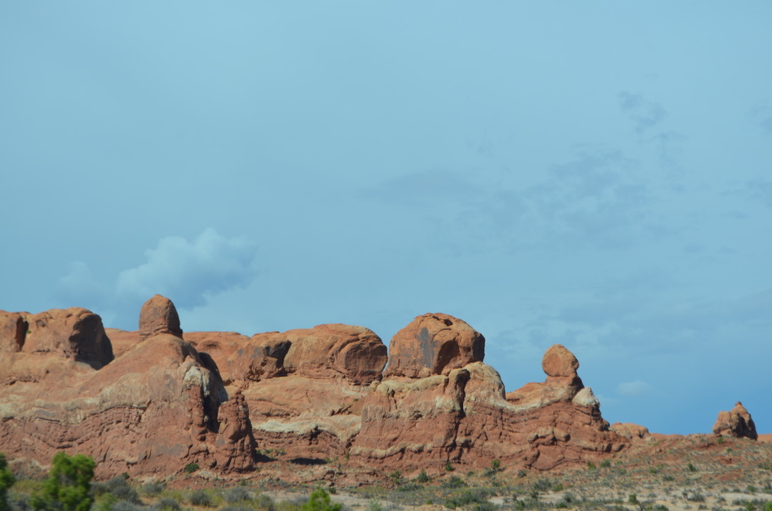
Many of the formations looked as though they were frozen beings from a Star Wars movie . . .
We named this one “Peeps” after the little yellow marshmallow things Diane loves.
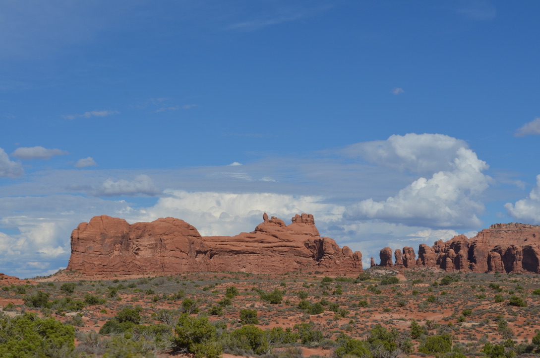
I think you get my drift. It was all quite amazing seeing all these rocks carved by the weather. Stunning. Then we finally ran across the one everyone’s seen. It takes a hike to get close to this one, but we were OK just viewing from a distance. We’re all old, you know.
The stay in Wells, Nevada was a nice rest for us after the grueling trip over the mountain. I’m healing nicely, in case you’re wondering, and looked forward to getting on the road heading east. We did that yesterday and made it to Provo, Utah without any incident, as far as I can remember.
Here are some photos of the Wells stop:
Oh, wait! The RV overheated a few times on that trip because we climbed a lot of hills (mountains) again. Went down a lot of them, too. Kind of evened things out. The end result was a long trip across the Great Salt Lake Dessert where the Bonneville Salt Flats reside. It was an hours long trip on a I-80 that goes straight like an arrow all the way from Wendover, Nevada or Wendover, Utah (take your pick) to Clive, Utah. Actually, there’s a curve out of Wendover, but after that it went straight for the next 50 miles. Or so. The entire way we were surrounded by salt flats that kept a history of all the people who had driven off I-80 for one reason or another. My suspicion is that the tire tracks and ruts we saw were made by folks with 4-wheel drive vehicles who needed to see if they could get in and out of all that salt.
After the Clive exit the road gets a little more interesting to the point where we figured we’d entered Freeway Hell as we entered the outskirts of Salt Lake City. The traffic is incredibly bad there and gets worse, the deeper one goes into the city.
Thankfully, we turned south on I-215 toward Provo. Our destination was Elks Lodge 849 where we hoped to score 3 of the 5 RV spots that have full hookups. Sadly, after navigating some of the worst afterwork rush hour(s) we arrived a wee bit late, and they only had 2 remaining. We were leading the pack so missed the entrance to the lodge which wasn’t very well marked.
When we arrived Cliff and Terry, who didn’t miss the entrance, were hooked up and we were prepared to spend the night dry camping. But, Cliff had a better idea. The spaces were long enough that we could park two RV’s in one spot so we got permission to double up. The lodge manager agreed and that’s what we did.
It was imperative that we get electric, at least, because our fridge decided all the sudden that it wouldn’t work with propane. It needed AC power. So, we ran our generator most of the way to make sure our food wouldn’t spoil. We were also looking at running it all night, too. Cliff saved the day.
We spent the evening in the lodge, which is quite nice. Actually, it’s hands down the nicest lodge we’ve ever seen. It has an elevator and lives on a few acres of city center property.
We would have had dinner there but there no cook. So, we got permission from the bartender to get something from Wendy’s and bring it in to eat. After that we retired to our vehicles and had a restful night. While waiting for our orders to arrive, one of the customers showed up with this …
This morning we had planned to leave at 9 am but didn’t leave until 10 am. Or later. First stop was a Love’s refueling depot for fuel. As you might expect, I got confused about how to get into the pumps and didn’t make it until Terry and Cliff were finished. As we were finishing up, Terry showed up behind us at the pump and followed us out. Thinking he and Cliff were coming along behind us, we headed for I-215 south to the exit toward Green River, Utah (our next destination) we learned that Terry had pealed off to wait for Cliff and Susie who were at the nearby Cracker Barrel for some reason. We were already committed to entering I-215 so chose to continue on and let everyone know we would wait for them at a likely turnout, or rest area on up the road.
We made it a long way out of town and wound up on a lookout overlooking the windy road we’d traversed to get to the top. Setting up some chairs we lounged comfortably behind a barrier, searching for our friends as they climbed the mountain.
Even Max took his turn as a lookout.
We were surprised when everyone showed up fairly quickly. Once we were joined up we sailed non-stop into the Shady Acres RV Park in Green River, Utah.
The landscape made a dramatic change as we travelled, revealing a little of the scenes we looked forward to seeing on a grander scale. Our plans for tomorrow were hashed out over a wonderfully spaghetti dinner at the Unger abode. By the time the girls were done talking it was dark and we were looking at a scary walk home. It was only about 40 feet, but it was scary. Just ask Diane. We had to use my phone flashlight which revealed that ants like to work at night. There were many of them trotting around our feet on that short trip.
That’s it for now. Tomorrow starts a new journey as we begin our quest to visit all the national parks we can in Utah.
Just for fun, in case he reads this, I wanted to show Les how dirty our truck got as we dragged it across Utah.
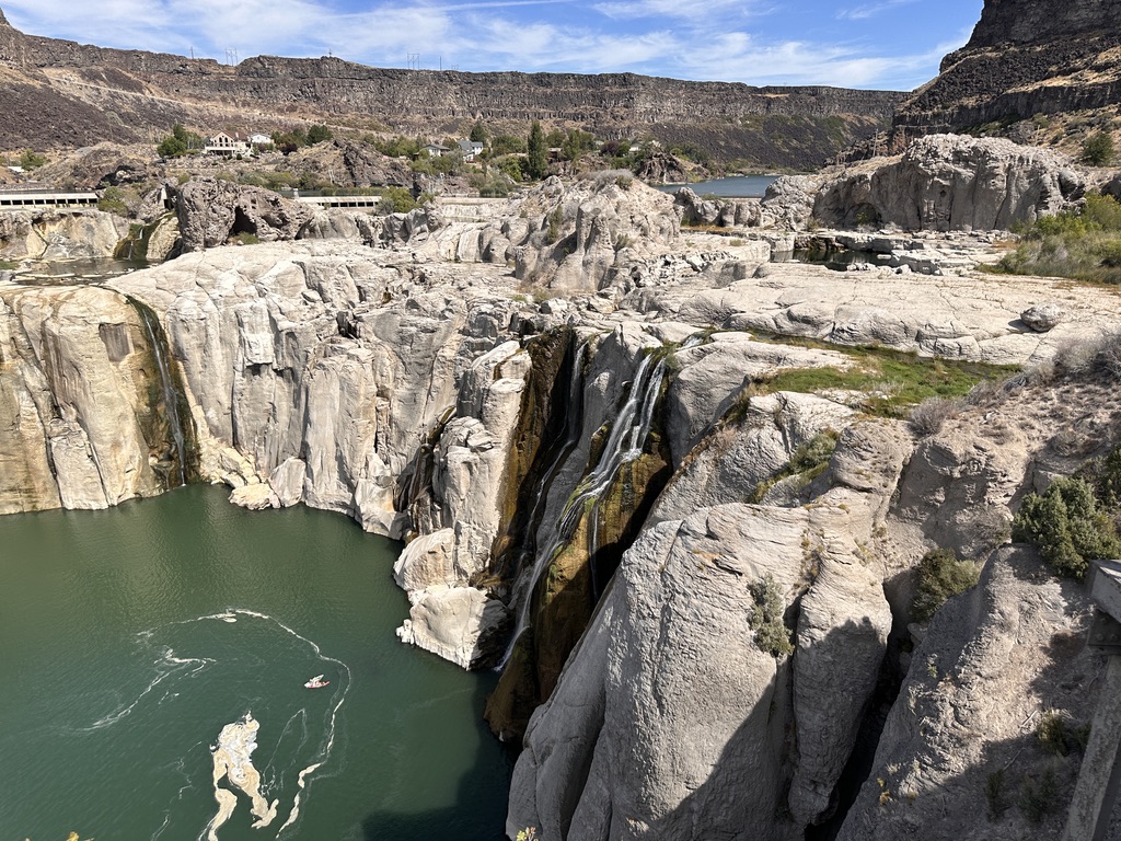
Today we decided to do some exploring of the area, so that’s what we did. We’ve travelled through Twin Falls many times in the past but never stopped. This time we did. Cliff and I alerted our Elks Lodge bartender about our plans, and she suggested that we go to Shoshone Falls. It only took a little bit of investigation by Diane to get those directions.
All six of us piled into Terry’s new (2015) suburban and headed south from Jerome, crossing over the bridge spanning the Snake River that trickles serenely through the deep canyon it carved on its way to Kennewick, Washington where it flows gently into the Columbia River on its way to the Pacific Ocean. Whew! That was a mouthful.
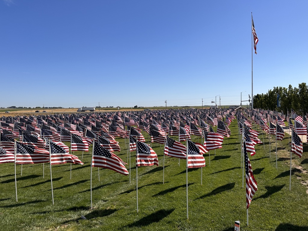
Before crossing the canyon, we stopped to investigate a field filled with 3,000 American flags on display next to Highway 93. It’s called the field of healing, honoring those who died in 9-11, and other tragedies our nation has suffered. I spoke with a VFW member who was currently on guard and learned that the field is filled with flags every year at this time. VFW and American Legion members mark out the flag locations and the High School football team places all 3,000 flags. He said it only takes them about an hour to complete it. That would be worth watching.
The Snake River Canyon is quite beautiful. There are lookout points on both ends of the Perrine Bridgethat you should take advantage of if you ever pass this way. Our goal this day, as mentioned above, was Shoshone Falls.
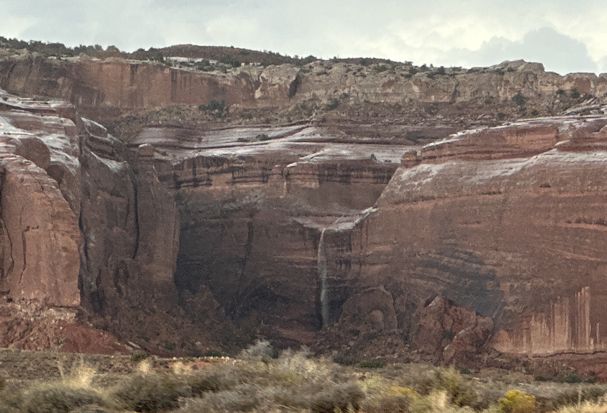
The website link above shows the falls when the water is plentiful and flowing fast but this time of year the falls are not nearly as stunning. But the land over which it flows is stunning in its own way. Nestled safely above the waterline in the canyon are a number of homes that make me wonder how loud it must be to live there when the river is at its best. The falls were reduced to a trickle for our visit.
After this it was all downhill as we headed back to the RVs on the other side of the river. Carolann then took Terry back to the hospital emergency room to get some relief for his brutally painful back. That’s a story for another time. Short version is they returned ‘home’ around 8:30. Cliff and I teamed up to drag Terry to their abode and got him situated in a prone position on his bed. He appeared to be comfortable but it was hard to understand him because of the medicine they gave him. Hopefully he’ll be on the mend tomorrow because we have a fairly long drive to Wells, Nevada.
Now, for that long drive … Turns out Highway 93 from Twin Falls south to Wells is all uphill. No one told us that. At the very tippy top we crested over 6700 feet. I blame the rarefied air for causing our engine to overheat and give us fits. On some hills we dropped to 30-40 mph to avoid engine damage.
Finally, we started back down the mountain and made it to a small village with a fuel station where I thought it would be a good idea to add some more water to the radiator. Not thinking, something I do quite often, I opened the cubby hole where the overflow tank lives and twisted the cap off to gain access. Turns out that diesel rigs have pressure caps on their overflow tanks, like a radiator, and when the water’s hot it expands rapidly to escape when the pressure is released.
The cap blew out of my hand as the boiling water ejected, splashing really hot antifreeze all over me as I attempted to escape the fountain. It lasted a long time and pretty much emptied the tank all over Diane’s pickup. I couldn’t believe that no one took a photo of this rare event. It was very exciting.
The main damage to my body was limited to my left hand that received the initial outpouring of super-heated water, so Diane and others stood around me pouring cold water all over the burned areas. It felt really good. Then I slathered my hands and face with aloe gel to keep the skin from falling off. It worked nicely. Nothing fell off. Yet.
Wrapping a wet towel around my hand I resumed our drive to Wells which was about 30 miles away. After making only one wrong turn we finally made it to the Welcome Home RV Park where Diane had previously made reservations. It’s a beautiful little oasis along I-80 West about 15 miles from Wells. We all got parked, Susie cooked supper and all was good with the world. I was even able to get the Dish antenna situated where it connected to the two remaining satellites available and got to see the Ducks and Texas Tech game. My hand hurt a little, but we don’t think it’s going to fall off. It seems to be working just fine as I hammer on my keyboard.
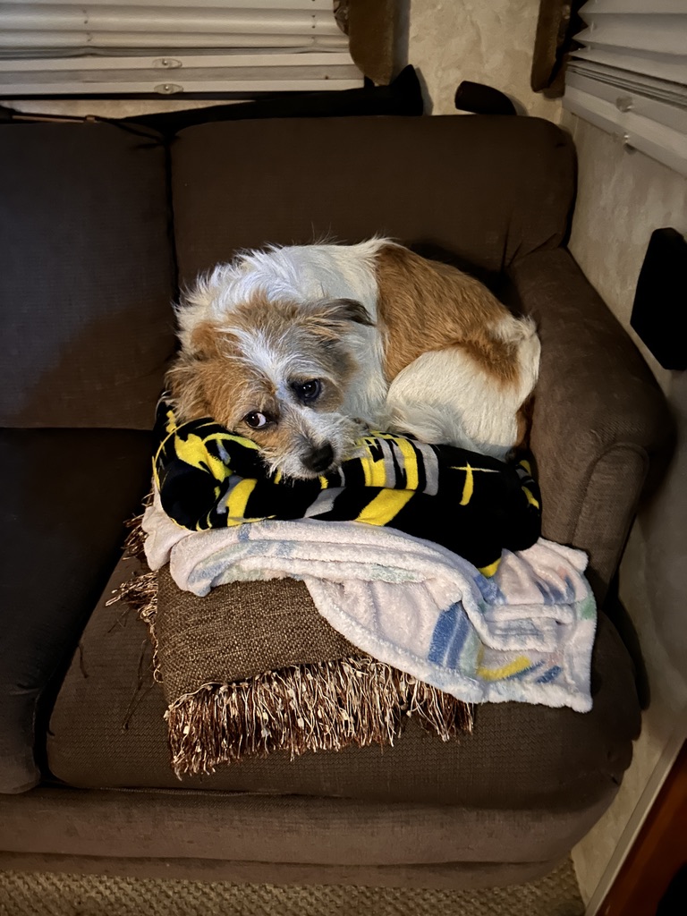
In parting, here’s a shot of Max feeling sorry for me …
Oh, and that place where I mentioned that Cliff and I manhandled Terry into their rig was a lie. All of it. He’s still in pain after the doctor’s visit but he can still navigate pretty good. We think he’s going to make it.