
This morning we packed a couple of sandwiches (that I made), gathered up the dog, and headed for Canyonlands. The entrance to this park is down the same road as Arches, but it’s farther from Moab and on the right instead of the left of Highway 191. That’s my kind of exit. I’m kind of anal about NOT crossing oncoming traffic lanes to view “something” because getting back on the road could be problematic and fraught with danger. If it’s right turn, I’m good to go. Getting back on the road safely is solved by going to a traffic light and waiting for everyone on your left to stop and let you out. Simple and safe.
Unlike Arches, the Canyonland entrance is much further off the road. Arches is like, right there, as soon as you exit Highway 191. And it’s a right turn! Apparently, that’s the reason Arches requires entrance passes because the traffic would quickly back up, blocking Highway 191, keeping people who had already seen Arches from getting to lunch in Moab. Backing up traffic to enter Canyonland isn’t an issue. The backup could be miles long and wouldn’t interfere with folks going to lunch in Moab.
Thankfully, there was no long line of cars entering the park, so we sailed right through the gate. Just zipped right past the ranger as if she didn’t know we were there. excerpt, she gave us maps and told us some rules about parking ONLY in designated area, like between the lines. Turns out that about half the visitors ignore that rule.
Although the views from our vehicle were stunning, some of the more interesting views required long walks. I did 3 or 4 of them and logged over 5 miles on my Fitbit. I got many photos to prove my prowess. I also have tender legs and a sore back from hiking up hills and down gullies. It was fun, though. Most of the time I was alone in the wilderness because I chose to follow Robert Frost down the paths least traveled. None of my fellow travelers knew where I was so it was a bit exciting until I got to the part in my head where it said, “if I collapse, or fall down out here, I wonder how long it would take to find me?” It wasn’t something that concerned me. It was just a curiosity.
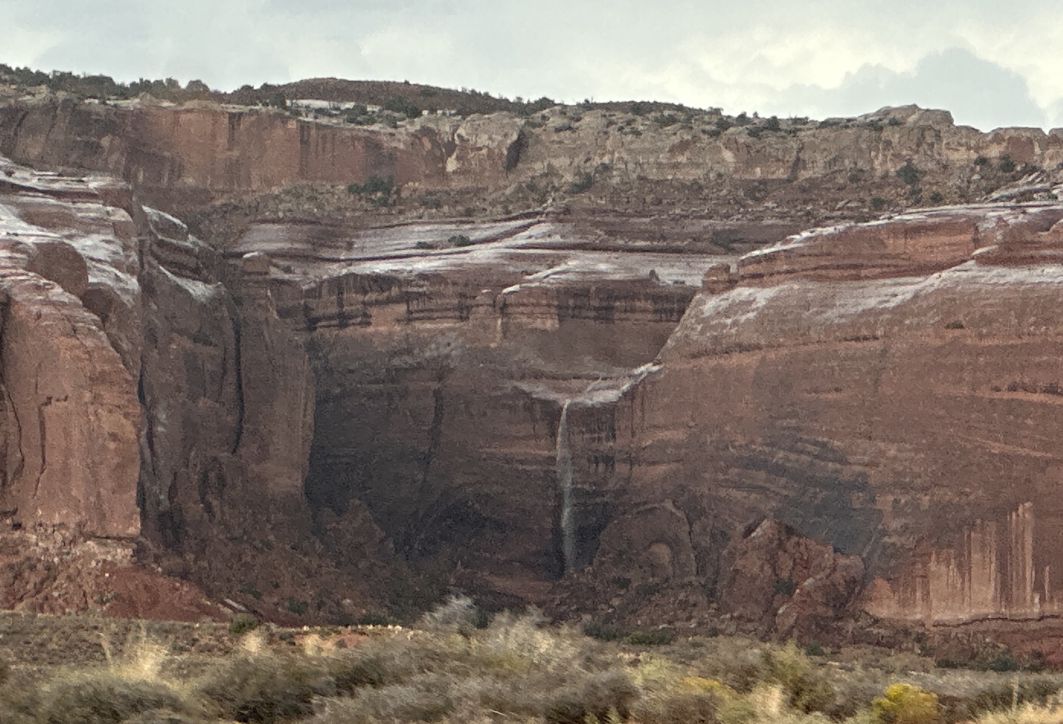
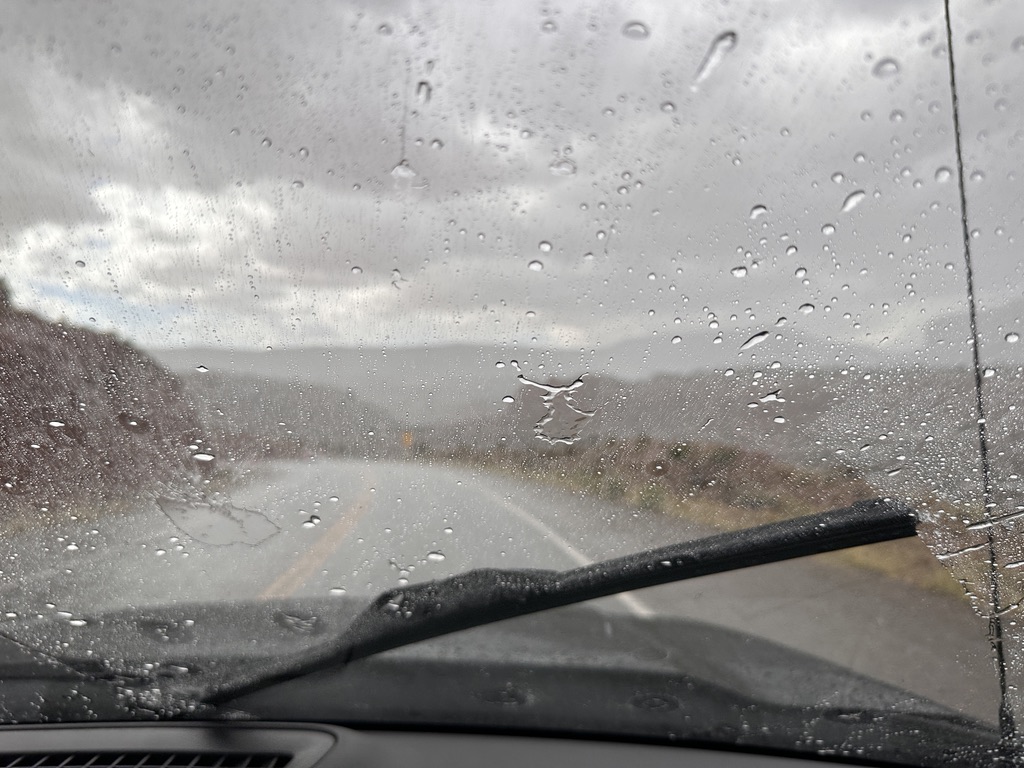
After seeing what we wanted to see we headed for the exit and were greeted by a tremendous thunderstorm that washed all the dust off the truck. The water running off the mesas did so in the form of impromptu water falls that was quite nice. It was a demonstration of how the surfaces of the plateaus are so smooth. I tried to get photos, but it was raining too hard to get the camera focused through the rapid swipe of the windshield wipers, and there was no way I was going to roll down my window.
Before we left for this day’s travel, Diane broke out the crock pot and started the base for tortellini soup. I chopped up the vegetables she needed. The pot was on low so cooked nicely while we were gone. Upon return from our journey, she added the tortellini’s while I did something else. Don’t remember what it was, but I did something.
Then we gathered at the Unger’s residence for a nice dinner on their patio. The rain was long gone, and the temperature was just perfect of us Oregonians. The soup was so awesome that I plan to have more for lunch before we pull the plug on this location and head for Loa, Utah, our next stop on this adventure.
Now for some photos.
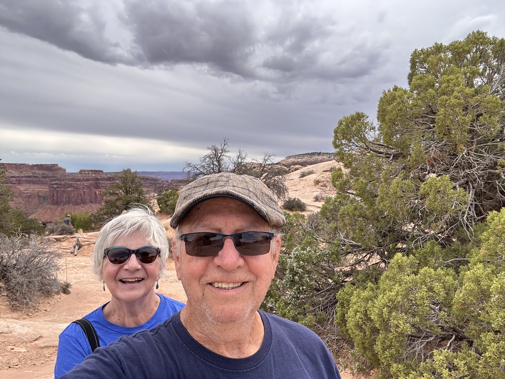
This is us . . .
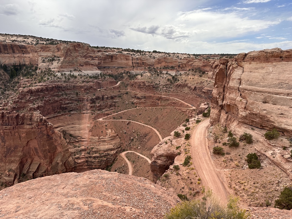
This was my first walk. I don’t know what it’s called but, oddly enough, it sits on the edge or a deep canyon.

The un-named rock up close . . .

I got close to the left side discovered that it’s a long way down with no barrier to keep uncareful people from falling off. So, I went back to the truck. It was more safe there.

A little further away is this view of a dirt road that daring people are invited to take to the bottom of the canyon, 1400 feet away, and drive all over in the canyons. Looked fun but Diane didn’t want to do it. Had she agreed she would have had to tell me later how it went.

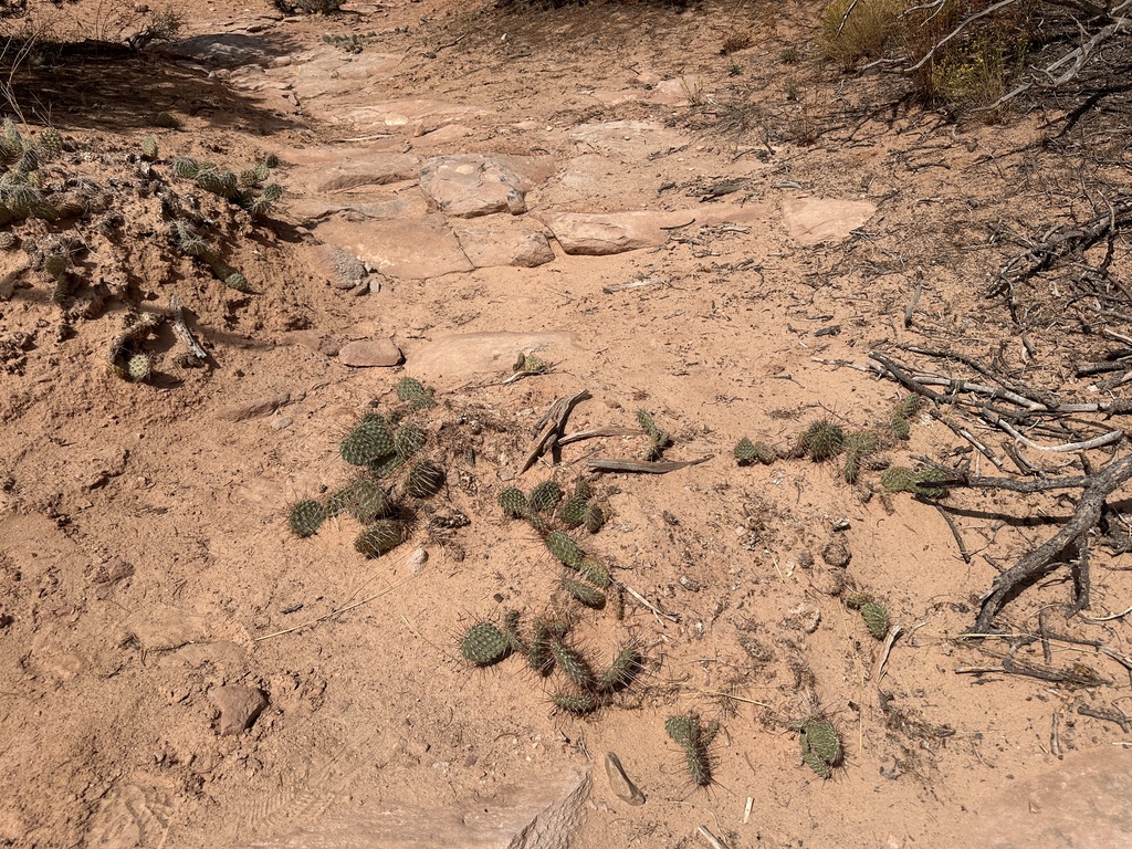
Driving on we encountered a trail to Mesa Arch. Feeling frisky I decided to see what it was like and what Mesa Arch actually looked like. Prickly pears were abundant.
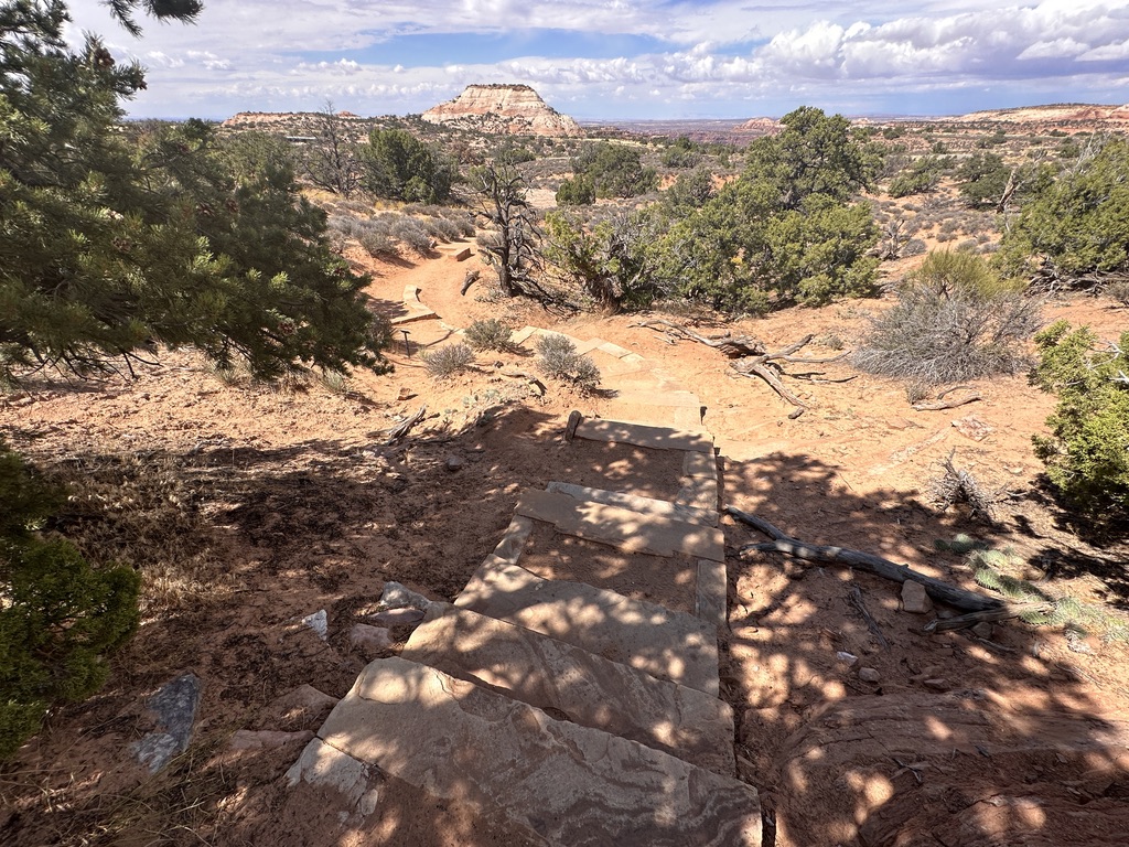
The trail went ever upward with large slabs of stone steps on the steepest. Each step is composed of three pieces of stone about the size of a railroad ties. Sand in the area fills the space between the pieces. It’s evident that many people choose to talk around them. Me? I used them. There were literally hundreds of these steps. Making them must have taken a considerable amount of time.

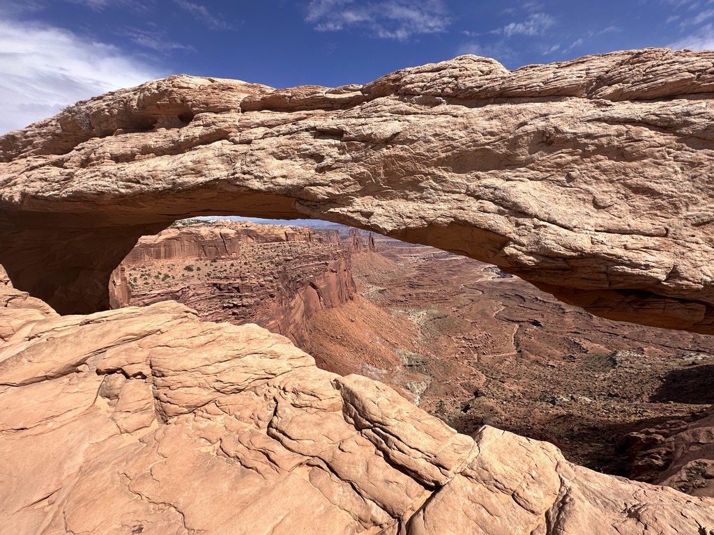
I finally made it to Mesa Arch. Many people were standing around talking and taking in the view, so I took this picture.

It doesn’t look like much until you get closer where you can see how it frames the vast area below.
Then I went back to the truck, but I did it by continuing on around the formation that leads to Mesa Arch. On that part of the trek I didn’t encounter even one other human being. More than once it crossed my mind that if I fell down, for any reason, I might be laying there for some time before someone found me. It made me more careful than I normally am.
I made it out safely and we wandered around a bit before heading back to camp. Before we made it back to the park entrance, we were blessed with a tremendous thunderstorm that made it necessary to see if our windshield wipers still worked. It came on slowly, then blossomed into something to behold. It was kind of nice, it was.
Once we got away from the park we were out of the rain, and it was smooth sailing back to Green River.
